This was a flight that would have been considerably more difficult in the single engine DA40. In part because as I was departing Friday Harbor (FHR) I was climbing into the clouds at the same time as I was crossing water. The forecast along my route of flight said that there would be four thousand foot ceilings a lot of the way, so technically I could have just flown VFR at 3,500 feet from Friday Harbor, past Seattle, down to the west of Portland, over Eugene, on to Roseburg and then cut through the hills to Medford. Then it was meant to clear up.
I would have been pounded by rain a lot of the way, until about Roseberg. So three hours of tense, close-to-the-ground flying and some reduced visibility due to the rain. I was glad to be climbing into the clouds. My weather briefing for the flight to Medford included all the hits: mountain obscuration, cumulous nimbus with convective activity, icing above 7,000 feet, and 'possible turbulence from 15,000 feet down to 5,000 feet. I was flying down to Los Angeles after almost three weeks in Friday Harbor. I'd get to see Rudy, spend the night, and climb on the red eye flight to Logan. Nell had remained on the East coast for projects she was chasing.
I entered the clouds at about four thousand feet somewhere over the Puget Sound. I was listening carefully to all of the other planes talking to the controller to get some feel for the situation. Although I had the sugar-alcohol fluid to pump out onto the wings I was a little low on it and I wasn't sure if I had more than about an hour of it. If I could climb up above the clouds I would be all set. I asked if they had any pilots reporting the tops of the clouds. A Compass pilot said they had hit a last cloud at 12,500 feet. I had filed for 11,000 feet so I asked the Seattle controller to send me up to 13,000 feet. I was at about five thousand feet and climbing a little faster than 500 feet per minute. I had the FIKI (flight into known icing) system pumping. I might have waited longer than I should have to turn it on out of a fear that I'd run out of the fluid.
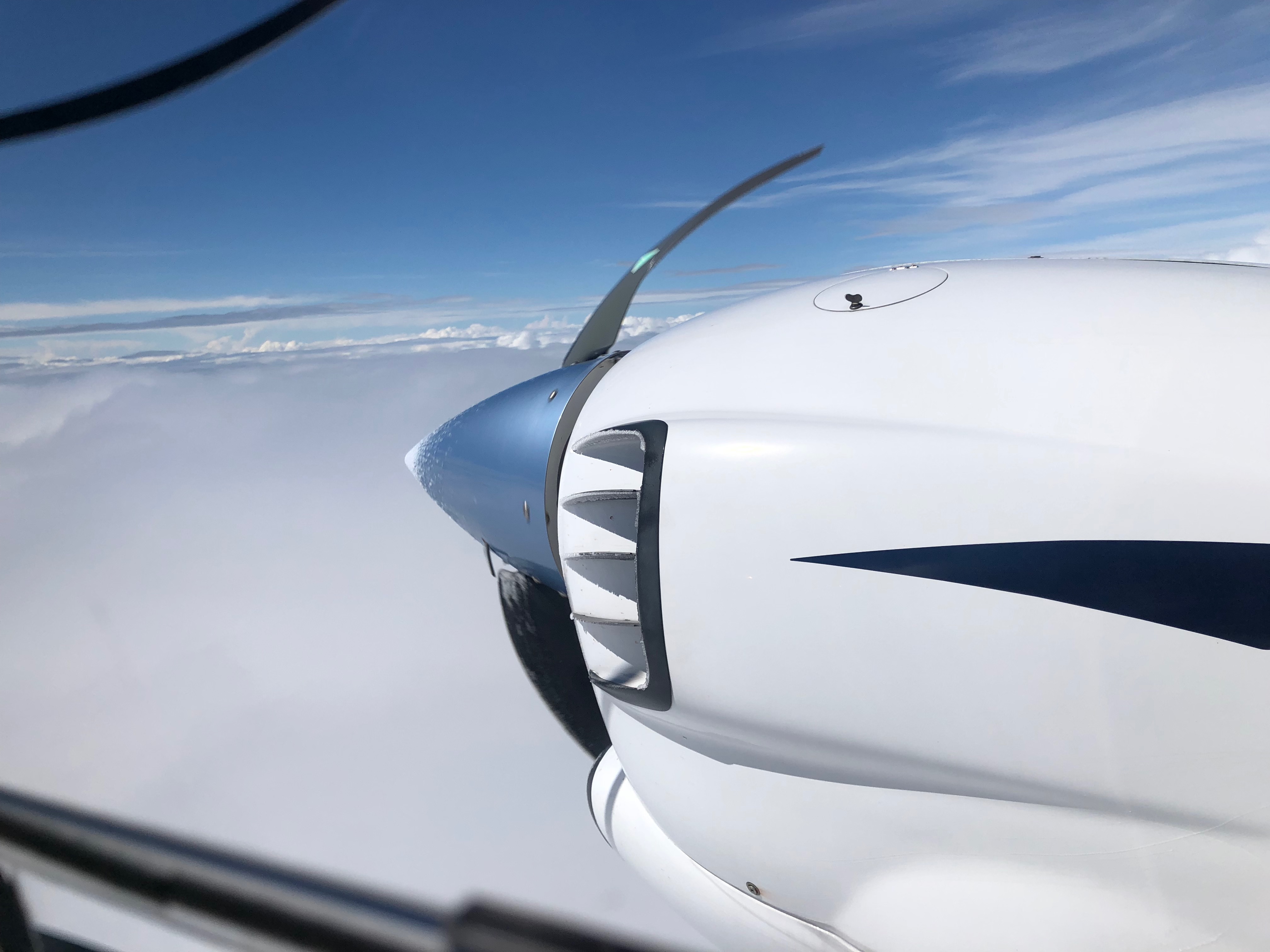
Thirteen thousand feet, icing from seven thousand, so I had ten minutes of climbing before I was at my safe altitude. I peered at the wings to see if I could see the fluid streaming from the micromesh on the leading edge. It looked like I could. That magic stuff would make it impossible for the ice to form on the wings. As seen in the video at the start, it did not keep the ice from forming on the windshield. They know you're instrument flying at this point and flying is more important than seeing out the window. They have a button to squirt some on the windshield when you want to clear it. I had down that a moment before I took the video.
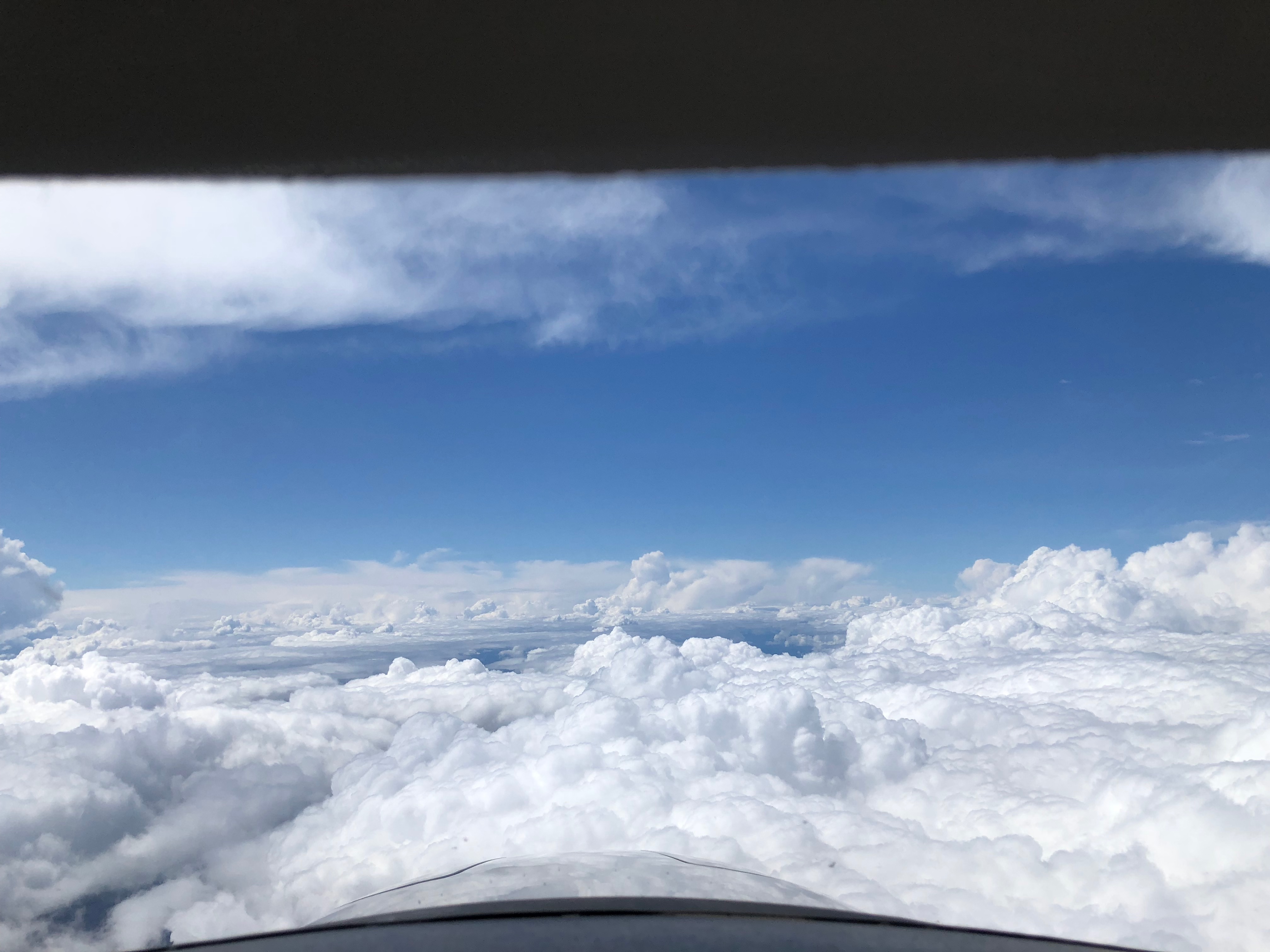
It was a wonderful feeling to break out on top and feel the warmth of the sun. The OAT (outside air temperature) was 22F and dropping, but the cockpit was a little greenhouse.
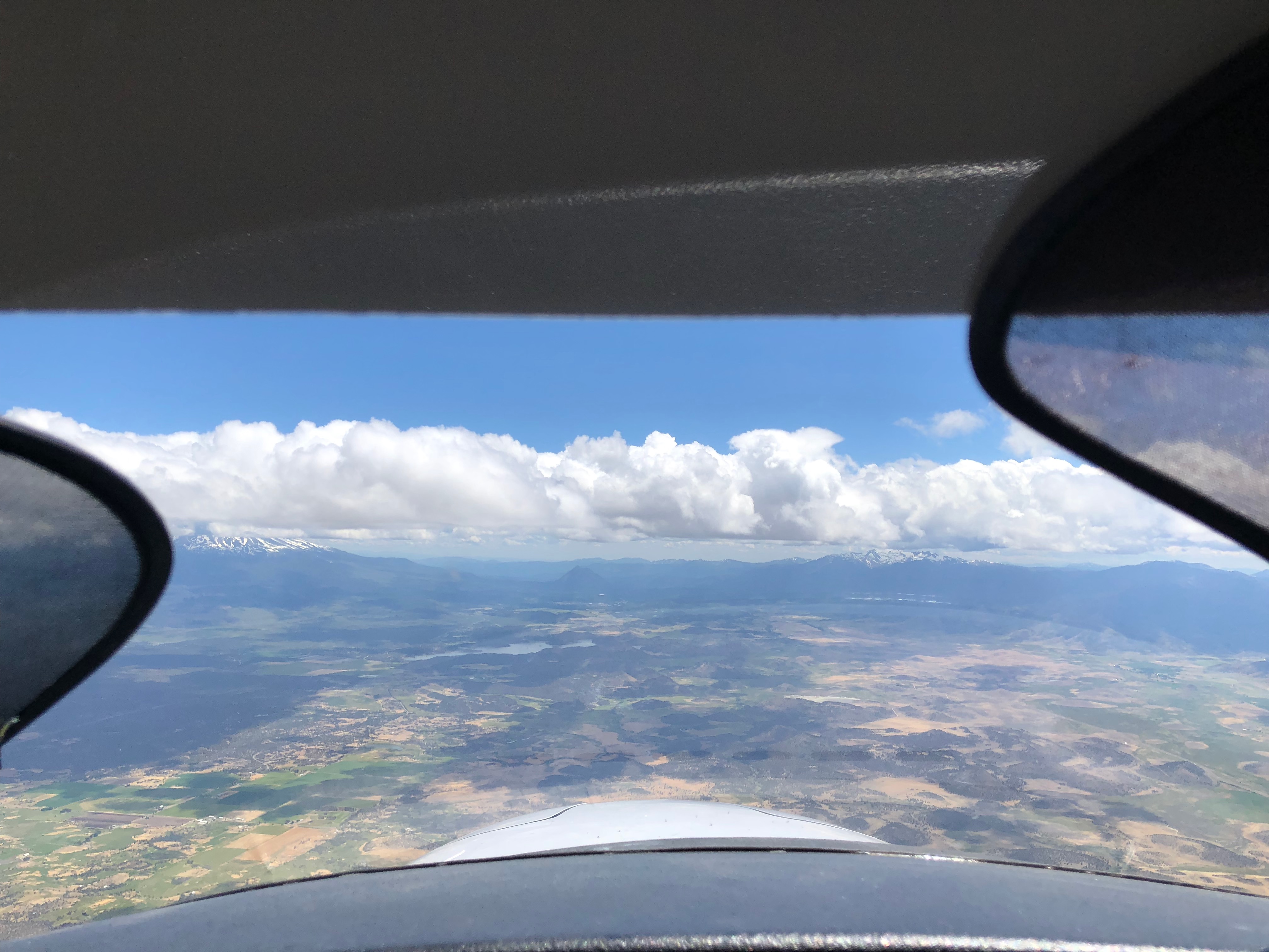
Looking ahead, I could see that some of the weather was above me. I climbed up to 15,000 with permission from ATC. And they allowed me to deviate left and right of course to steer around "build ups." As I came abeam Portland I could hear the regional jets going in and reporting moderate turbulence on the descent, between 10,400 feet and stopping around 5,000 feet. (Moderate turbulence: "Turbulence of greater intensity. than 'light.' Changes in altitude and/or attitude occur but the aircraft remains in positive control at all times. It usually causes variations in indicated airspeed. Occupants feel definite strains against seat belts or shoulder straps. Unsecured objects are dislodged. Food service and walking are difficult.") Since I didn't want to discontinue the food service (a delicious pastry from Cafe Demeter), I was very glad that I was not trying to land in Portland. More importantly, I would try to remain above everything and use the option of descending and running along under the clouds as a last resort.
As I headed south of Portland I could see a line of clouds ahead. I've written about this before, but it is very difficult to get an accurate picture of what is up ahead. Those clouds above the horizon in the distance could be a vertical wall of clouds. But they could also be a long sheet of horizontal clouds stretching away from me, way up high and to the horizon. Both would look that way. And getting closer doesn't always answer the question. The clouds below me solidified to a 'deck,' and appeared to stretch under the storm wall. But did it go all the way through? I didn't want to descend into bumpy air to find out and then have to claw my way back up again. I angled more to the west.
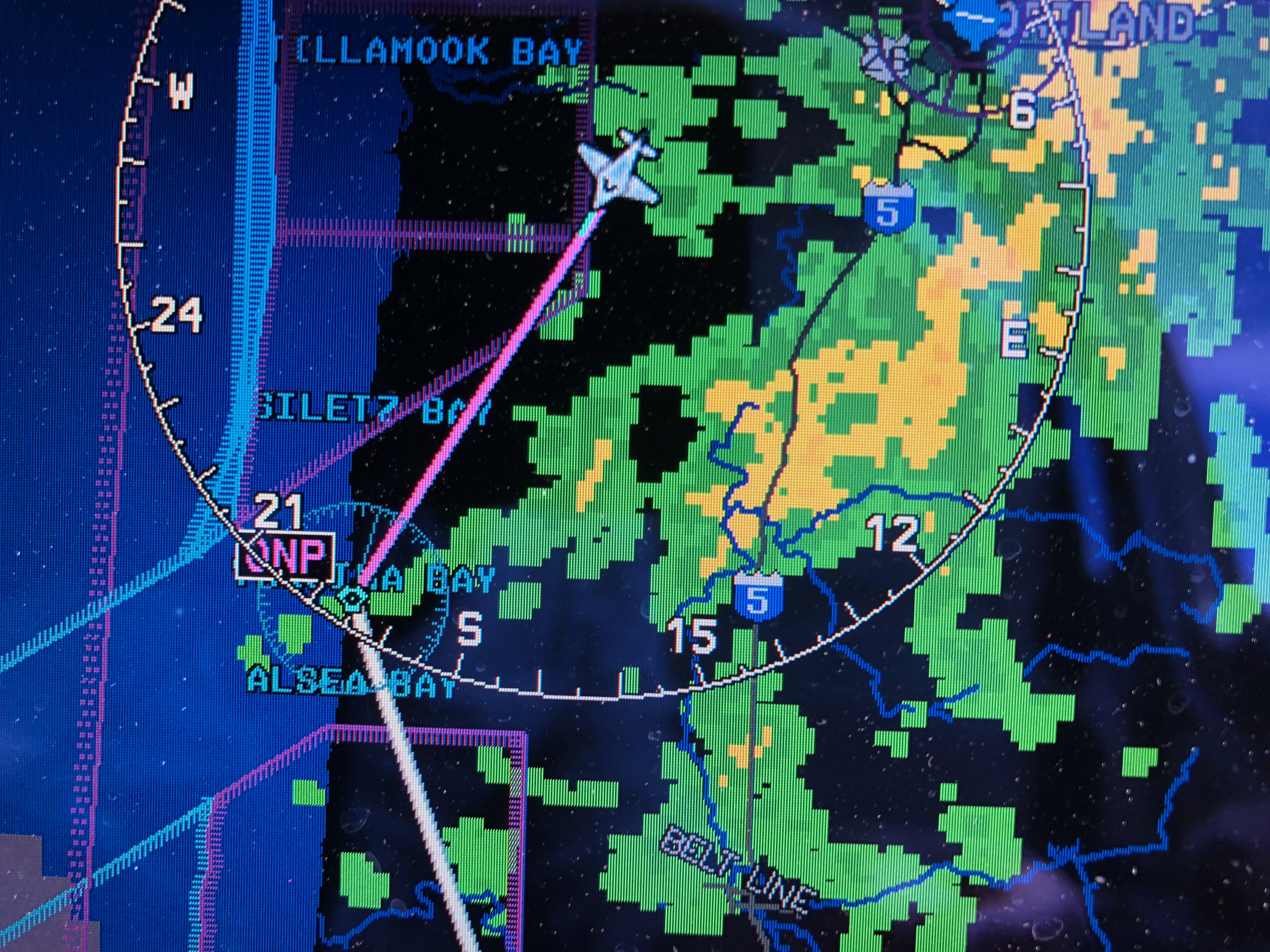
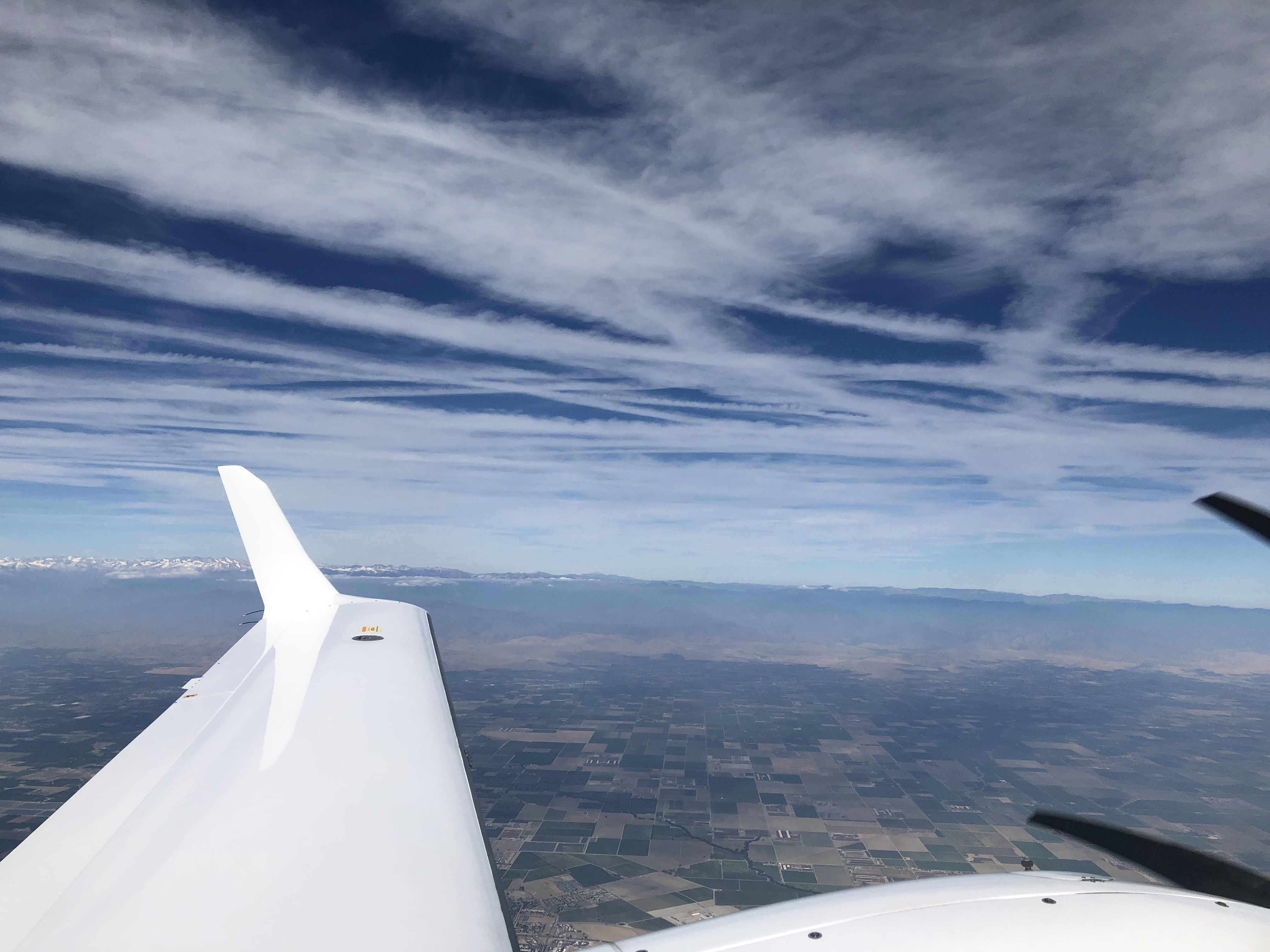
At one point I was angling all the way out to Newport Municipal, and wondering about heading out over the Pacific if that meant getting around the wall. I climbed to 17,200 before seeing that going over it wasn't a possibility. Under it didn't look too good either. I motored on toward Newport while I considered the options. Just as I was getting to the Y in the place label "SILETZ BAY on the map below I saw what looked like a small hole in the wall. Maybe. I shifted my head back and forth and peered at it. It really looked like a hole. About the size of a house, which in a wall over thirty miles long and at least three miles high is a small hole.
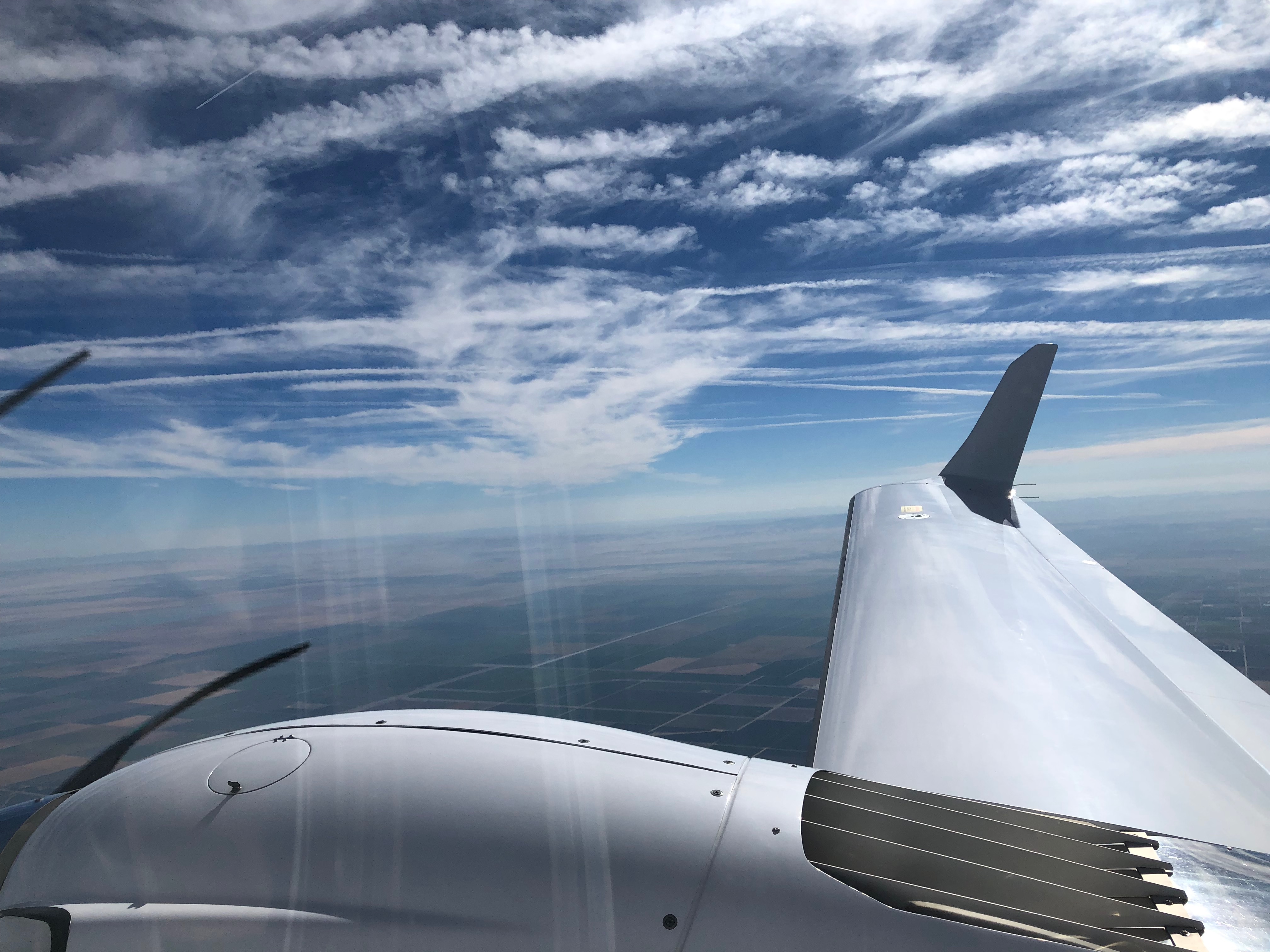
Sometimes it's really unclear if I'm looking at blue sky through that sort of hole. Murky blue could be a cold, dark grey that is just more storm. Flying through that hole and having to turn in a tight 180 to come back out wouldn't be fun. But it would be an adventure. I turned toward the hole, dropped the gear, beginning a swift descent to about 13,800 feet, which looked to be the middle of the hole. As always, I let air traffic know what I was up to. When I began wandering west I canceled the IFR portion of my flight plan and now I was just talking to them for VFR flight following.
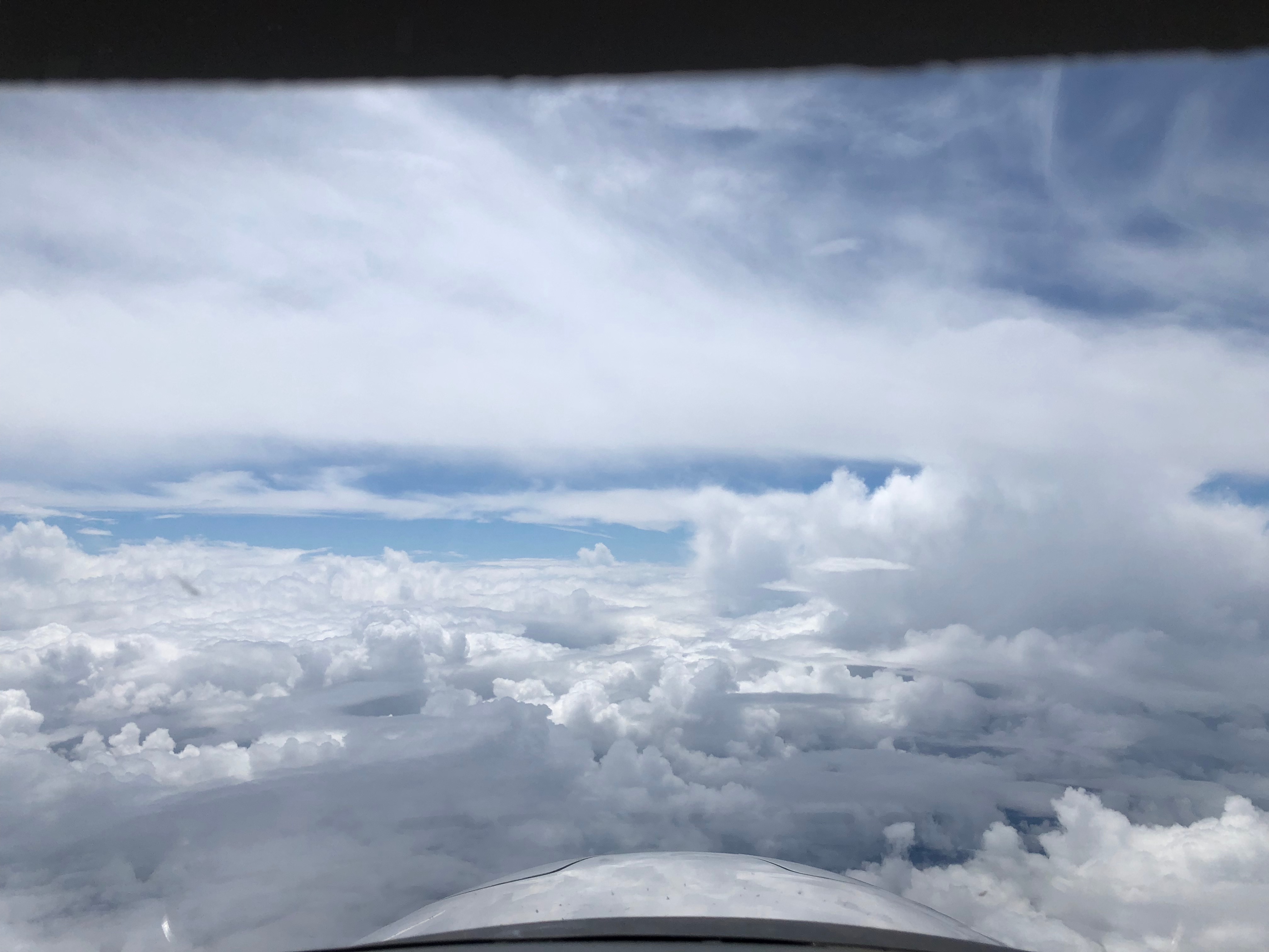
As I got closer the hole appeared a little bigger. Since clouds are in constant motion it's hard to know whether it got bigger or just seemed bigger. I dropped to 13,400 as I arrived on the northern side of the wall. The hole might have been twice as wide as my plane, although the edges were really wispy so it was hard to tell. I could see definite blue sky beyond and some very white clouds, which meant direct sunshine. It looked like there was a pillar of cloud beyond the hole. I aimed a little to the east of it, since the wind was coming from the east and I didn't want to go west of the pillar and have it spread out over me.
I hummed through. A huge storm was in my way and I managed to sneak through a chink in the armored wall (the really high-energy portion of it was twenty miles or more away from me and I wasn't going to be in IMC even this far from it). The blue sky beyond stretched on forever and, a little less than an hour to go to Medford, that was the last bit of adventure for the whole flight.
10 comments
Colin, excellent write-up. (caption on 2nd to last photo should probably be Central Valley)
Thanks! (I don't know my valleys as well as my airports.)
Quite an adventure Colin. Well Done.
Great blog entry Colin - I find it inspiring how you are using your aircraft as a tool - have read almost all your posts and was worried you’d stopped! Hoping for some more. Fortunately we don’t have weather like you do where we are in South Africa!
Also, check out my attempt at flyblogging... flyinggas.co.za
Very cool. Are you working on your instrument rating? You might like Chris Houston’s blog: https://warrior481.blogspot.com/
Not quite at that point yet. At the moment I’m riding the crest of the 150h “master pilot” wave and trying not to kill myself before exiting the danger zone for new PPL holders. I have set myself a target of 300h before making a call on doing the Instrument. I really enjoy Chris’ blog - also been a long time reader.
Wow, long-time reader. I will try to post a little more regularly. I'm still flying the wings off the plane whenever I can. If we ever make it to SA I'll give you a shout. I love seeing places from the altitude of little planes.
Please do!
I remain impressed by the capability of your aircraft and enjoyed this example very much. I am reminded of my hangar-neighbor who has a turbocharged, straight tail Bonanza that he treats like his personal airliner and I find myself in a very different part of the capability spectrum. Glad to see another post from you. Like Mike, I was wondering if you were still blogging.