This weekend was the whole plan coming together, as if there were a plan. But at 12:30pm on Saturday afternoon, Adam and I climbed into our rented Piper Cherokee (N777VP) and took off from Santa Monica into the most gorgeous, clear, vibrant, Southern California sky you can imagine. Adam was at the controls and I was on the radios with the chart in my lap.We flew east, along the foot of the Hollywood Hills, over the Los Angeles City Hall and landed at El Monte (EMT). Cute little airport with a single strip and a tower, like Santa Monica. There was a beautiful v-tail Bonanza waiting to take off, and Adam did a really nice landing. Coming in we had a little trouble seeing a Cessna that was in the pattern and it’s always exciting to hear the tower announce that traffice “should be at your twelve o’clock, opposite direction.”
We took off and headed further east. We had the hardest time finding the next airport. We were trying not to use the GPS unit that the plane has, and instead finding each airport (except Big Bear) by dead reckoning and peering into the sprawl of Los Angeles ahead of us. We must have flown over the highway we were going to use for navigation, and followed the wrong one. When we called the tower she told us that we were south of the airport, not west of it. That confused us a bit. She helped a little more. Then we saw a lake that it was marked on the chart next to the airport and headed for that. We came in right over a drag strip, which was pretty cool. Very nitro and big rubber.
That third airport was Brackett Field at La Verne (POC). It looks like it has a nice little diner on the field.
Then I flew us on to Corona (AJO). That was a CTAF (Common Traffic Advisory Frequency) airport, and we reported as we came in over a dam. The dam held back water flooding a wooded area into swamp. It was great stuff to see from the air. Corona is chock-a-block with vintage planes. Some very fine looking aircraft, including some WW2 war birds.
We climbed out on take off and banked right over the swamp. It was nice being the intelligent autopilot and having Adam say, “Hold a heading sixty-seven and climb to two thousand five hundred…” so I could keep glancing at the needles and getting to watch out my window. (My flight instructor said that the two things that I should be careful of while taking my check ride were my tendency to stare out the window and my tendency to just stare at the instruments. Apparently I am meant to move my head a little and not get all fixated. I’m working on it.)
Adam navigated and radioed our way through the airspace of Riverside airport to a tiny little strip called Flabob airport, at the edge of Riverside. It is home to the first chapter of the EAA (Experimental Aircraft Association) and there are a flock of little kitplanes parked at the tie-downs. It looks like a fun airport to fly out of. I had hurried my landing, turning base a little too soon, because as I was flying downwind someone announced that he had just entered cross wind. That means he was behind me and although I have the right-of-way and priority to land, I allowed him to hurry me along. My final was a little shorter than it should have been, which meant I had to slip down to the beginning of the strip and I was landing a little fast.
Adam was a little concerned on touchdown because I was drifting off center line to the left and the tarmac was really narrow. We were safe, but he thought I might be close to dropping a wheel into the grass. There was no tower here, either, and the doors had rusted (or quaked) off of most of the hangers, so the planes sat under cover, but in plain view.
We switched at the end of the runway and he flew out toward L35. That’s Big Bear. We had just left RIR (Flabob) at a little over seven hundred feet above sea level. Big Bear was at close to seven thousand feet, and in order to clear some of the ridges on the way in Adam climbed to over eight thousand five hundred feet. That’s high enough that the engine and plane perform a little differently. We were apprehensive doing our first high altitude landing. During training we were specifically forbidden to use L35 on any of our cross-country flights.
We used the GPS so that we could be sure we were headed down the correct valley to Big Bear lake. It was a good thing we did, because if we were going by my instincts and dead reckoning I think we would have flown down the wrong one. Possibly two of the wrong valleys. Nothing that would have been dangerous, just annoying and time consuming. It might have even been a good lesson, but we didn’t feel like spending the time learning it, so I punched L35 into the Garmin and it drew a pink line on the little LCD screen right to the airport. Adam realized it was over the next ridge.
We flew along the edge of Big Bear lake, calling into the common traffic frequency to announce our position. We could hear reporting for a couple other little airports, including an airport that serves ultra-lights. We heard someone say, “Hey, Lance, have you gotten that thing up to three thousand feet yet?” and the pilot of the ultra-light answer, “Almost made it that high today.” If I had one I would definitely want one with a ballistic parachute on it. Adam’s landing at Big Bear was perfect, and made me want to try one. It will have to wait until next time. We went into the little airport there. There’s a place to eat and a rental car place. The mountain air was crisp and clean, no smog. You could smell the pine trees ringing the lake. I wanted to fly Nell and the boys up for a hike and dinner. I drained one of the little Fiji bottles, polished off my potato chips and climbed back into the plane.
The valley which contains Big Bear runs from the low desert of the Los Angeles basin up to the higher desert of Yucca Valley, Twenty-nine Palms, and the Joshua Tree National Monument. As we took off from Big Bear and did a smooth one-eighty, we flew over the low-water part of the lake and over the lip of the end of the valley. We dropped down onto the welfare community of Flamingo Heights. Lots of trailers and little tiny houses down long dirt roads. We followed the one paved road south to Yucca Valley. It was another time that we were concerned that we would miss the airport, but there it was, right off to the east of the road where it was meant to be.
Adam circled around it, announcing our position, and brought us in. It was a nice landing on a bumpy, narrow strip. There was no taxiway, and the wind was calm so at the end we just rotated the plane, switched pilots, announced our intention to return to the sky, and buzzed out of there. (That was Yucca Valley, L22. It looked like there might be food right there at the edge of the strip, but it was a little unclear if it was operational.)
I flew the runway heading, 060, right to the next airport, Williams (L80). It was a little X of asphalt and dirt in the middle of the desert north of the Western entrance to Joshua Tree. On the chart only one of the runways was shown, but as we flew toward it we could see an intersection of runways. When we got closer it was apparent that the second runway was unpaved, and I think it would be no fun at all to land on a dirt strip that is interrupted in the middle by a bit of pavement.
We entered the downwind straight in, turned to land and came in nice and low over a house that someone had decided to build on final. That is always mysterious to me. It’s one thing to buy land near an airport, but right on the final approach? The pavement was in rather poor shape. We landed nicely, turned around at the end, Adam got out to pee, and then we took off again.
The next bit of the trip was one of my favorites. We rode along over the Twenty-nine Palms Highway at 110mph, headed in the same direction that I am often driving only 65mph. I pointed out to Adam the Indian Cove entrance to Joshua Tree, where Nell and I take the boys to hike and rock scramble. I thought of how great it would be to land in Twenty-nine Palms, rent a little car and drive over for a hike.
We flew over the land Nell and I bought at the edge of Twenty-nine Palms. It’s a half a mile long in one direction and that’s certainly enough for a landing strip. We also flew over the only contractor who gave us a bid on building our house (too high), and looked down at his dirt strip. I think it might be unwise to hire a contractor wealthy enough to own his own plane, landing strip and hanger. We flew on over downtown Twenty-nine Palms (no Starbucks yet) and west to the town’s airport.
Because the Marine base, the town supports a landing strip long enough for private jets. Those are for the military consultants who fly in to get at the tax dollars. That’s nice for the little piston singles because in the heat, at the altitude of TNP (close to two thousand feet) it’s nice to have a runway four thousand feet long. I flew long on the downwind and then noted (again) that in all of the desert to build someone had chosen to put their little house right on final. It was a nice landing with just a little bump.
As we taxied back Adam pointed out that we had been gone for three hours and our airport hopping flight plan still included another nine airports. The truth is that if we weren’t renting a plane and we had the boys along (and as long as they were happy) we probably would have kept going into the evening. Although once we saw the haze that had pushed in near Palm Springs maybe we wouldn’t have. It was the sort of stuff that obscures the ground from a couple thousand feet up and makes finding an airport really difficult.
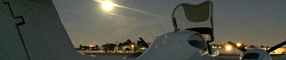
I took off from Twenty-nine Palms and we followed the highway back to Yucca Valley and then down toward Palm Springs. As we closed in on Palm Spring’s air space we called them for advisories and to get flight following. Adam then plugged SMO into the GPS and we bee-lined for home. He can tell the story of our flight back, because some of the ATC was entertaining.
Coming up next: Instrument Rating Flying and why it might be a good idea. (That’s from me. I have no idea what Adam has planned.)
