
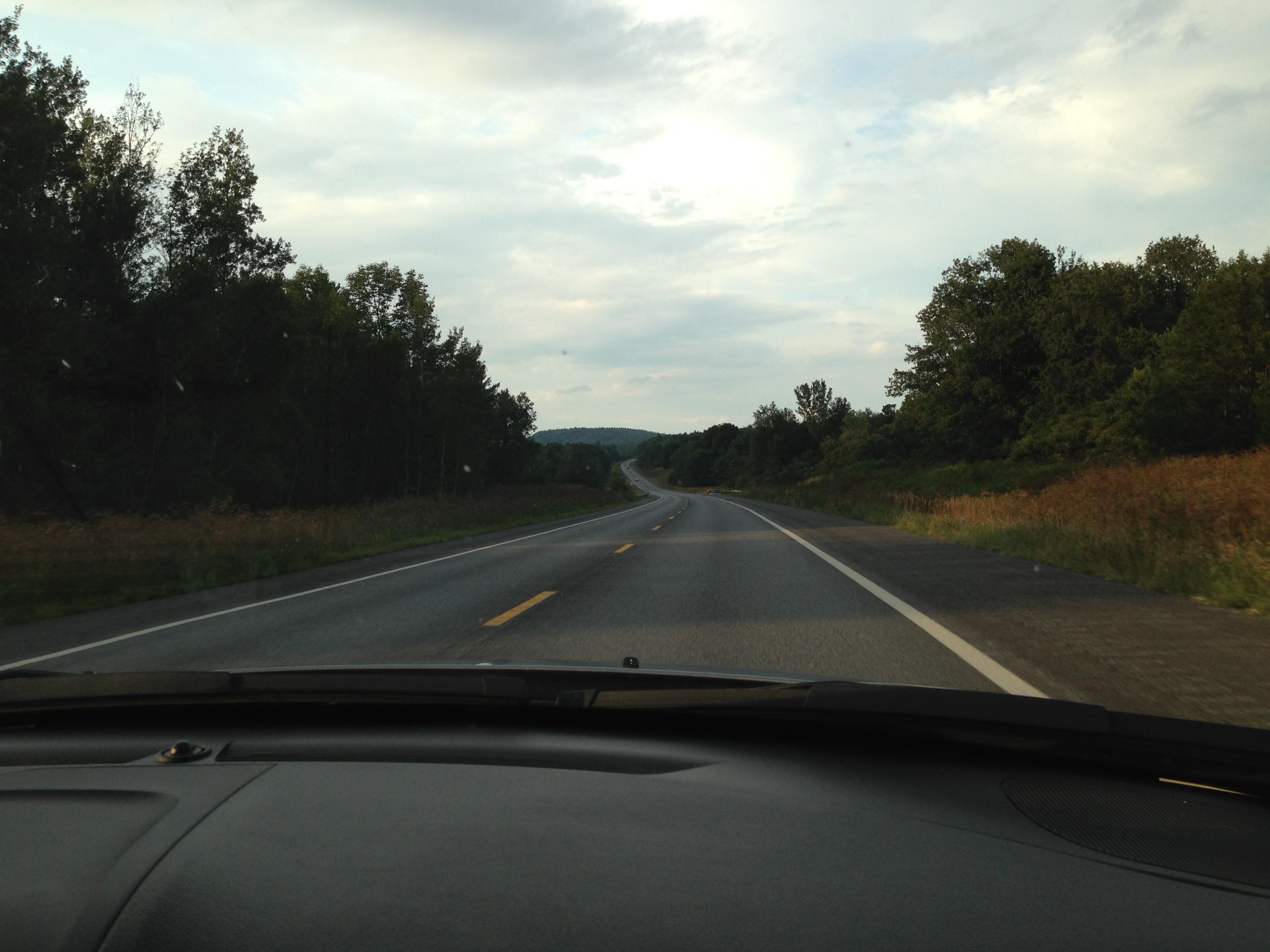
With the plane on the ground in Albany, we waited for the word that the alternator had been replaced and it was back in good running condition. We had a rental car and the drive from Pleasant Lake back to Albany was three hours. Nell had driven us to New Hampshire, which was a nice break for this pilot, and on the return trip I thought about a question she had asked, “Which is more difficult, a long drive or a long flight?”
(I am in the midst of helping Rudy, seventeen, learn how to drive. Sometimes I think of the phrase I read about being a CFI: “relaxed vigilance.” I spent a lot of my youth driving illegally, starting when I was twelve, so I didn’t subject my parents to these same cardiac events. So learning to drive both safely and with the sort of relaxation necessary for a three hour jaunt seems impossible. At the same time, Dexter, fifteen, is starting to learn how to fly. I had him fly a little bit on our return trip westward and he did great. It did remind me how hard it was in the first four hundred hours, though. I no longer think about holding altitude or holding a heading. The plane seems to do that on its own, allowing me to check the systems, sightsee, and plan our next stop.)
The truth is they are inverses of one another, but both are taxing at the end of a three hour trip. The mechanical portion of driving is impossible to disengage from. And, for me, the mental portion of flying cannot be interrupted for more than about four minutes. Long enough that you can read a paragraph in a book, but not more than that. So I have never been able to write anything more than a scribbled note (“community of the sky”) on my kneeboard in the hopes I could re-board my train of thought once I was on the ground.
Driving, my mind can drift. I have had long, thoughtful conversations with my passengers in a car. I am probably a little less cogent in the plane, because I am too often checking the landscape for my emergency landing spot, checking my fuel remaining against the time-to-destination, and flipping through the engine pages to check the mixture and the other engine parameters to make sure they are all within expected ranges. In the car, I trust a little computer to do all of that. But in the car I can’t stare out the window at some interesting part of the landscape for ten minutes straight. Unless, I suppose, it is directly ahead of me. (My old studio partner, Bob, always said I was going to die in a car wreck “within sight of an interesting building.” I have a habit of twisting my neck a little to check a facade detail or an interesting volumetric composition.)
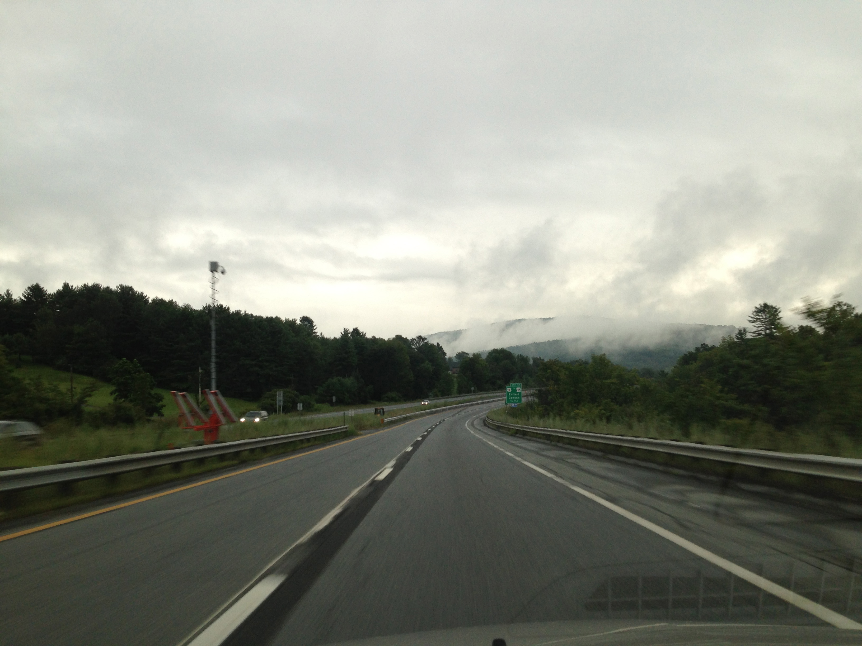
On the way through the mountains to Albany I kept checking the clouds. My mechanic in charge of the alternator replacement had said, “It’s all hooked up and runs great, but I wouldn’t make the first flight in IMC.” I was trying to decide what my options were. The further I made it into the drive, the more I thought that I was probably going to be filing to get an instrument clearance from KALB to KLEB. The mechanic had said that it wasn’t possible to charge the battery without removing it from the plane (false), and that it was a real pain to remove (true). He said the system was definitely working, that they jump-started the plane and the mechanic sat in it for twenty minutes, so there was a charge on the battery, but it probably wasn’t fully charged.
I didn’t fault him for not knowing how to charge the battery, it’s a glass panel plane with a lot of electronics. It sure seems like more plane manufacturers design their own electrical systems, making tough for one shop to track all the procedures for all the planes. To charge the battery in the DA40 you pull the 70 amp circuit breaker for the alternator and turn on the master switch to run on just the battery and then plug in external power.
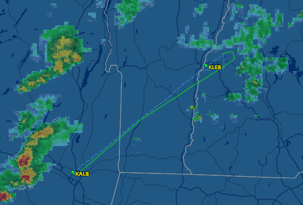
The Interstate wound through the hills and alongside the mountains I would need to fly over from Vermont into New Hampshire. I looked up to see the bottoms of the clouds brushing the tops of the trees along the ridge. I bet on the other side the cloud was sort of sitting on the slope. This is known as “mountain obscuration.” When you are navigating around mountains in a little plane zipping along at one hundred sixty miles per hour it can be a real drag because it increases your chances of running into cumulous granitus. I decided to file an IFR flight plan.
Since I was rolling along the I-91 at only sixty miles per hour, on cruise control, and there was no traffic, I filed my flight plan from my iPhone using Foreflight. A brilliant little piece of software. I think it took all of four taps of my finger. (Except I missed that I had last filed a VFR flight plan and so that’s what I did for this one. When I called Albany clearance to pick up my actual instructions for the flight they didn’t have my IFR flight plan in the computer. I had to call Flight Service there from the plane and re-file everything. I’m not sure if it would have been faster to re-do it from the iPhone. Possibly.)
I had done a very extensive run up. When I started the plane the battery surged power through that starter and it was running in fewer revolutions than the last few starts. (I suppose that’s not a surprise if the alternator was slowly dying, the last few starts were probably on a weaker battery, right?) So I was confident that the plane was fixed and in good shape. Nonetheless, I planned what to do if I got in the clouds and the alternator failed again. I was really only in them to make it over the ridges. If the alternator failed again I would have at least five minutes (and probably not more than half an hour) to talk to the controllers. And I would have twenty-five to fifty minutes with a working attitude indicator to get out of the clouds and into VFR conditions. The clouds were really only a problem over the mountainous terrain: there were high ceilings (and even some blue sky) over the valleys of upstate New York and Vermont. So if my volts started back down to zero, I would let the controller know and I would drop out of the clouds and land at whatever airport was VFR and closest.
Clearance said I was assigned “the Albany 4 departure.” Sure made it sound like a big, busy international airport. For me, that departure translated to “climb to 3,000 feet on a heading of 191, essentially the runway heading.”
The tower controller said, “Boy, you sure are getting out of here just ahead of these storms.” They were coming in from the west and north and within fifteen minutes of leaving they were clobbering the airport. I switched over to the approach controller, who was talking to commercial flight coming in, trying to squeeze them past the weather to the runway. “Westjet one five, it looks like if you come another fifteen miles east you’ll be able to squeeze between two smaller cells. That’s what company traffic did ten minutes ago.” “Westjet one five agrees, we’ll continue fifteen east.”
I climbed to the south and was in blue sky. Then I turned north and started ducking in and out of a few clouds. I switched to talk to Boston center and collected the weather at Lebanon. It was definitely not VFR, but it was unclear what the ceiling was (it changed several times during my short flight). At seven thousand feet I killed a mosquito who was trying to hitch a ride to New Hampshire. My niece Annie would point out that there are plenty of mosquitos in New Hampshire already. Maybe too many.
I liked hearing a United flight querying Boston center: “You do have us for Tampa, right?” “Yeah, yeah, I gotta get you due north outta here for some approach traffic. The next controller will turn you on course.”
So I was VFR and I could see the storm that was near Lebanon. As we crossed the mountains between Vermont and New Hampshire (I’m sure they have a name), I kept seeing the ground in little clearings of the clouds. I was tempted, more than once, to cancel the instrument approach and just skim under the clouds to the airport, which I knew was just a few miles north of me at that point. But I told myself it was worth getting the approach in my log book, that it was good to be “in the system” for a full flight, good to see the runway as I came out of the clouds and so on. I also never actually saw the airport, and it turns out that was for a good reason and it would have been a big mistake to cancel.
The Lebanon airport is on a hilltop, or at least on some raised ground above the town itself. There are a bunch of hills around it that are taller. I came in on the RNAV (GPS) RWY 25 approach, with ULAKY as my IAF (Initial Approach Fix). As I turned onto the final approach course, heading right for the runway and descending on the slope to the landing zone, the tower controller said, “One romeo delta, be advised that there are a couple clouds that are just off the hills here and making the instruments report a lower ceiling than we have over the approach end of the runway.” Roger, one romeo delta will report the runway in sight. And one romeo delta had also briefed the missed approach because maybe I was going to fly to a nearby airport and wait it out there.
I had the terrain awareness on the moving map, so I saw the red bits around the airport increase as I came down through the clouds. I was slowing the plane as much as I could, and waiting for the airport to appear in the little flashes I was getting of the ground-through-the-clouds. And then, all of a sudden, it was there. I could see just three hundred feet of the runway, with the two and five visible. It was peeking out under a cloud and between two clouds to either side, but if I can see those numbers I know it’s the right runway and I can put the plane’s wheels on that tarmac.
So I did, sliding between the clouds on either side, swooping down out of the clouds in the way that birds never do (they walk when the ceiling is this low). I had the wheels on the ground before the thousand foot markers, mostly because those weren’t in sight when I was finalizing my descent to the runway.
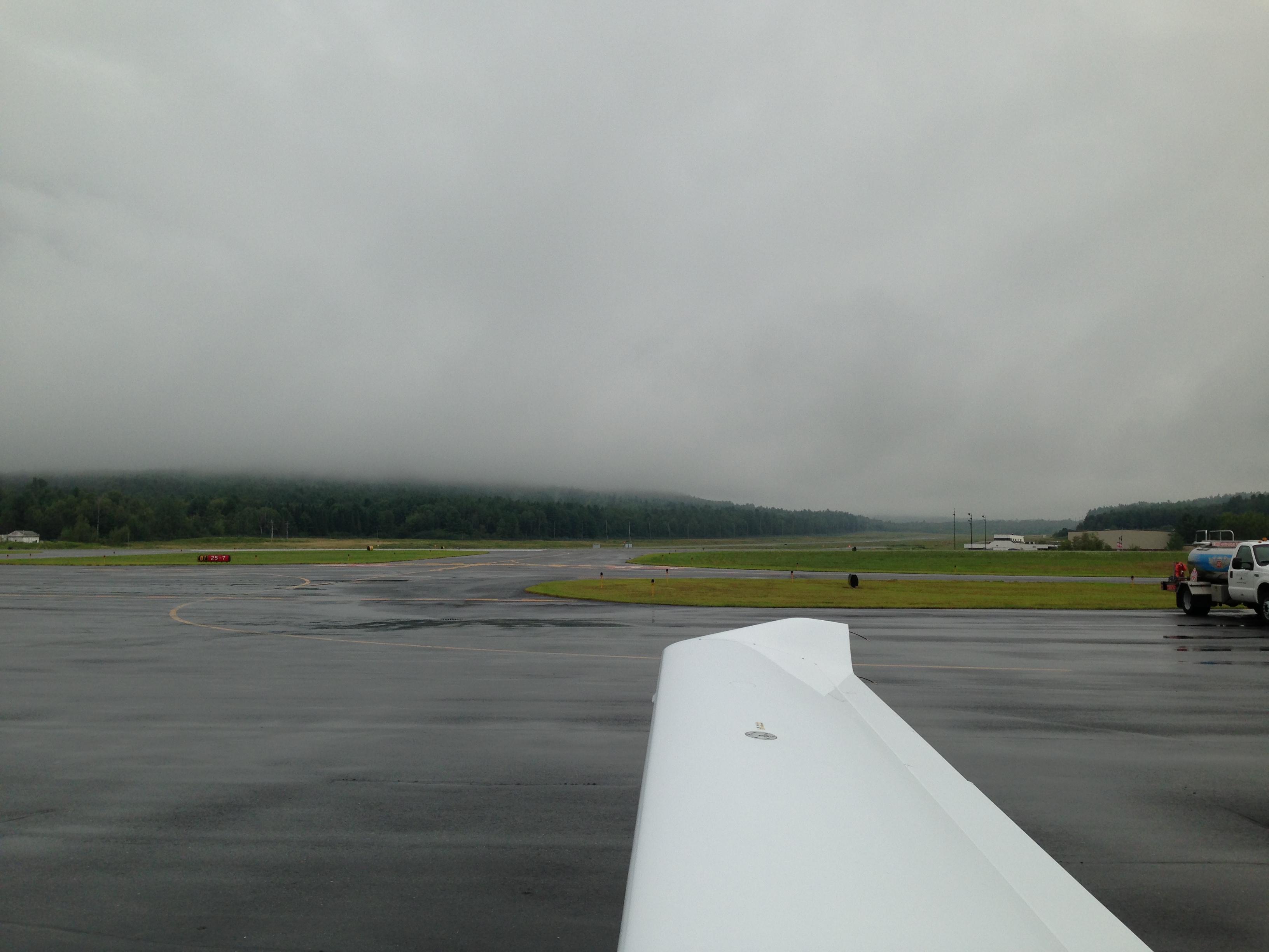
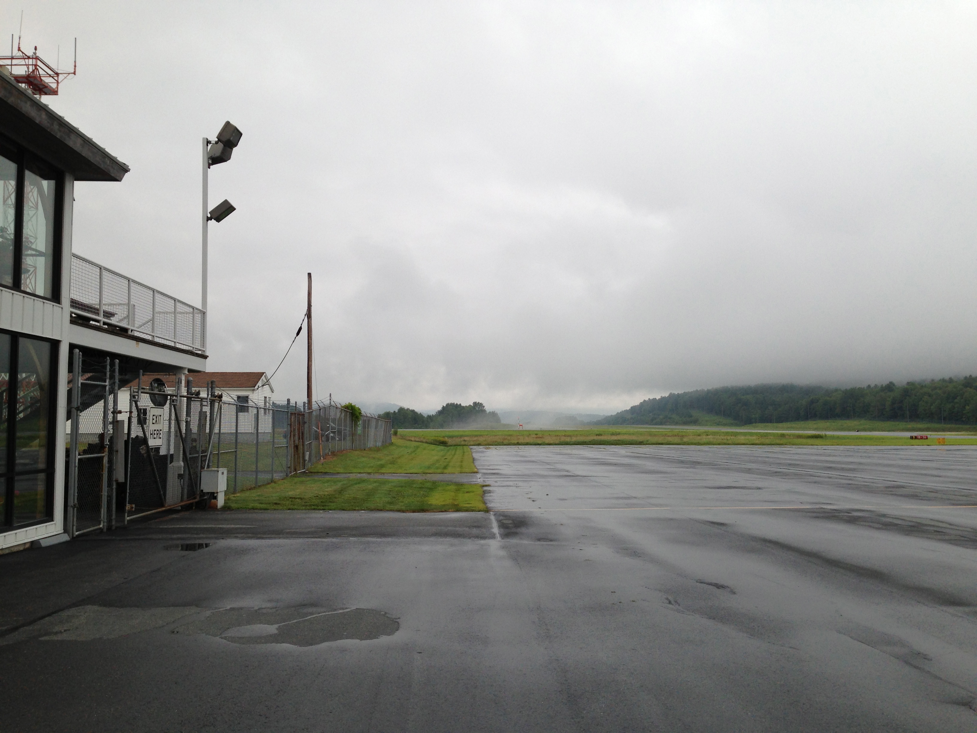
The tower controller seemed happy to have me on the ground. I shut down on the ramp by the FBO and took a photo. Once I unpacked and covered the plane I took another. And on the drive home I took one last one to show that in New Hampshire those clouds were definitely obscuring the mountains and I was really happy to have an instrument rating. The FBO lineman said, “You’re the only plane that’s landed all afternoon, it’s been nothing but clouds here.” Clouds. I fly in ‘em.
1 comment
Awesome!