The great thing about flying little planes is that you never know which flight is going to be an adventure. It could just be a milk run, or it could turn into the time you saw the most gorgeous sunset of your life as you flew past the largest wildfire you’ve ever seen, complete with fire service planes dropping fire retardant on the conflagration.
You never know.
I asked my friend Susan when she was going flying this week. We try to encourage each other to get up in the sky once a week. Well, I don’t need much encouragement. She said that she was flying on Friday with Jessie Davidson, a documentary filmmaker who was interviewing Susan about women in aviation. I said it seemed like a perfect excuse for the Catalina Hike and she invited me along. We were meant to meet at her plane at 2:45pm.
We got a little later start, with Susan grabbing a late lunch at the Spitfire Grill. We collected Jessie from the parking lot and headed to Susan’s tie down. Friday was along, Susan’s Maltepoo who accompanied her on her flight across the country.
With Friday bouncing at the end of her leash and Jessie loading her camera equipment into the luggage area, I helped Susan get the plane unfettered while she did a pre-flight inspection. Clouds were rolling in over the airport, but it was still really bright out. With the marine layer along the Southern California coast this is typical late Spring weather, a thin scrim of clouds up around three thousand feet that is barely two hundred feet thick. (The difficulty comes at the end of the day when the temperature drops and the clouds follow it, often they wind up sitting on the ground.)
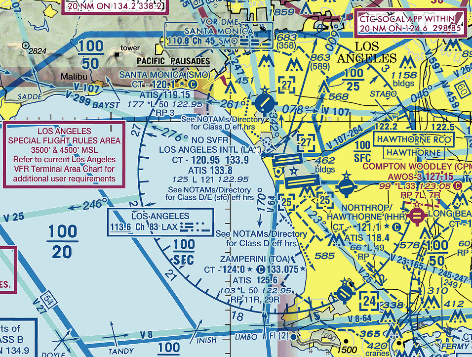
On the way to the airport I had checked the weather out at Catalina and they were reporting an overcast layer at fifteen hundred feet. (Use ForeFlight to get a full weather briefing at red lights in Los Angeles traffic!) We had the option of filing an IFR flight plan from Santa Monica to Catalina, but the difficult is leaving Santa Monica. In the past year or so the FAA examined the airspace between LAX and SMO more carefully and said that with both runways in operation at LAX, an airplane that took off from SMO on an IFR flight plan would be in conflict (with two miles of) an airplane that had to fly the missed approach off of LAX’s north runway. Subsequently, SoCal’s Air Traffic Control had to implement a policy where they create a twenty minute gap in the planes sequenced to land on LAX’s north runway, a gap during which they allow the plane off SMO’s much smaller runway to launch.
It means you can wait twenty minutes to take off from Santa Monica, where before it was almost instant.
First world pilot problems. So whenever possible I depart VFR and if I need to switch to Instrument Flight rules I get a “pop up clearance” from the controller I am talking to. I suggested that’s what we should do for the flight to Catalina, since the weather out there can change suddenly (foreshadowing) and we might not even need an instrument approach to land.
I have never flown the approach to land at Catalina. And I have never taken off from there on an instrument flight plan. I just don’t need to go there if the weather isn’t good; it’s a fair weather destination.
So we climbed into the plane and after a thorough run up by Susan, we were rolling down the runway for our requested “climbing right two-seventy and the Special Flight Rules Corridor.” I was sitting in the back seat, which is so rare for me in the Diamondstar. I enjoyed my view both of Santa Monica as we climbed away and of the dramatic clouds shifting around over the airport.
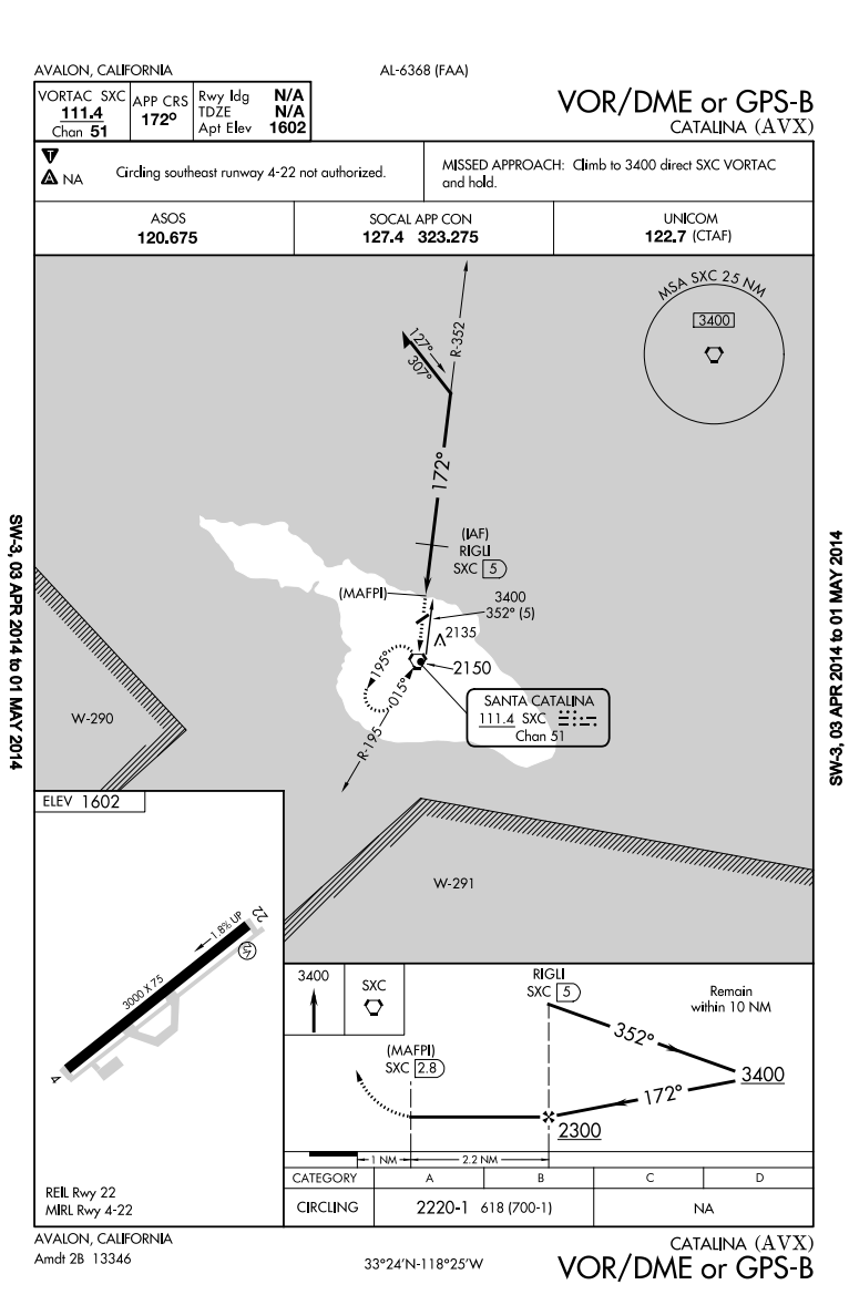
As we crossed through the LAX Class Bravo Susan tuned in the automated weather out at Catalina. They were reporting a 600 foot ceiling, so I pulled up Foreflight on my iPad and checked the approach. Uh, apparently we were right at minimums for the circling approach, which seemed like a bad idea. (I’ve flown into Catalina quite a bit and I know that the clouds can circle the topography of the island in strange ways and it wouldn’t be a good idea to count on a ceiling being a constant over the airport’s environs.)
We discussed a few other options for destinations and I said, “Let’s just fly out there and take a look.” I’ve had a few experiences, particularly recently, where the weather reporting didn’t include the subtlety of one end of the runway being covered by a cloud and the other end being wide open. As we crossed the channel toward the island we could see a large cloud formation hanging over it, with a definite shelf that was about 600 feet over the runway. But the cloud didn’t extend much past the north shore and we were flying over the ocean without a layer of clouds beneath us. So Susan descended to 1,700 feet and entered a right base for runway two two. There’s no way to do a smooth landing on the potholed runway at KAVX, but Susan was slow enough that we didn’t bounce hard and we were off the runway at the first exit.
I am not sure we could have aborted the landing and remained VFR and I am not sure what the regulations say about that.
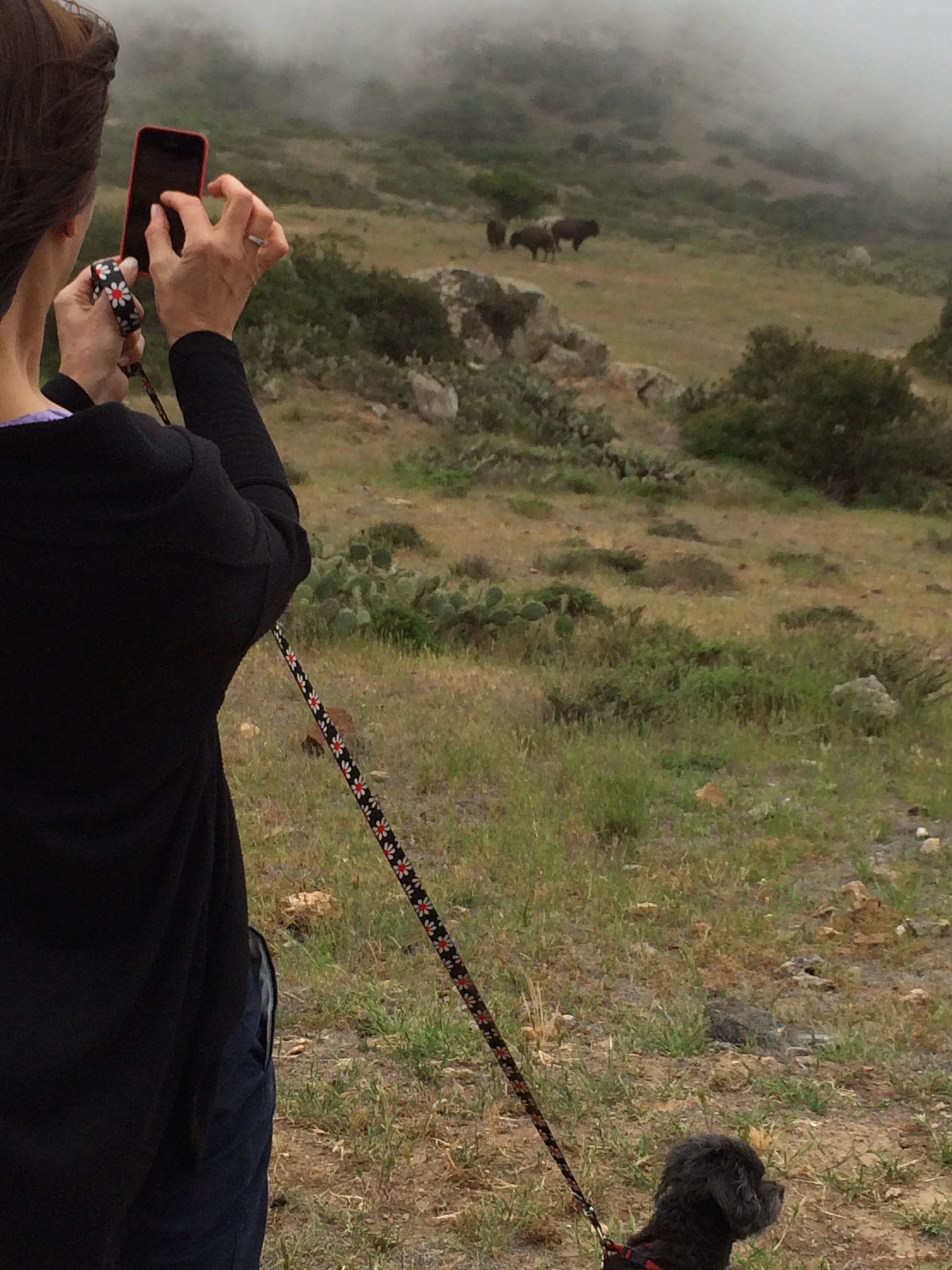
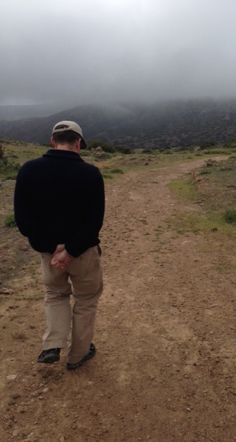
It was a wonderful day for a hike out there, brisk wind, a cloudscape that was almost as interesting as the landscape, and always the possibility of wildlife. Friday was on a leash.
I love the buffalo out there. I often muse about the same things when I take that hike: what the day is like for those animals, with such a nice piece of ranch and so few worries, what their dim memories are like of occasionally being swapped out for herd members in Yellowstone, how do the one
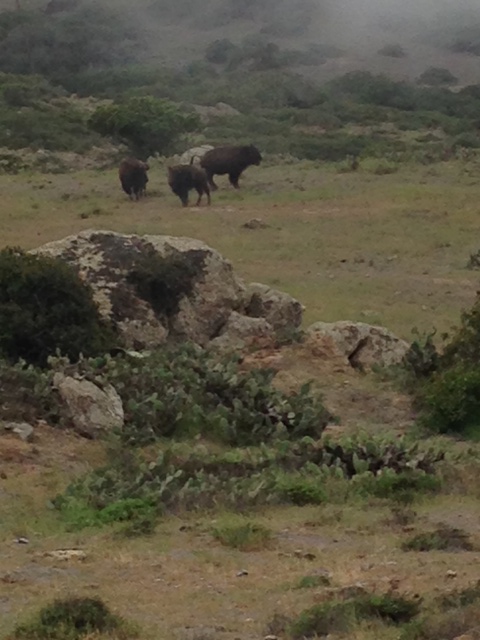
hundred fifty animals group, since I have only seen about fifty at a time at most? Do herd members hop from one herd to another? This is the first time I saw such solitary individuals. Susan snapped the three just before they started moving.
We continued our hike, talking about cross country flying (Jessie needs forty hours towards her commercial certificate and has a friend from Hungary who needs the same, so was trying to figure out the best ways to build those hours). As we circled the airport and kept a careful eye on the three, wary, charge-happy buffalo who circled part of the way with us, I noted that the clouds were getting a little more comfortable with the island.
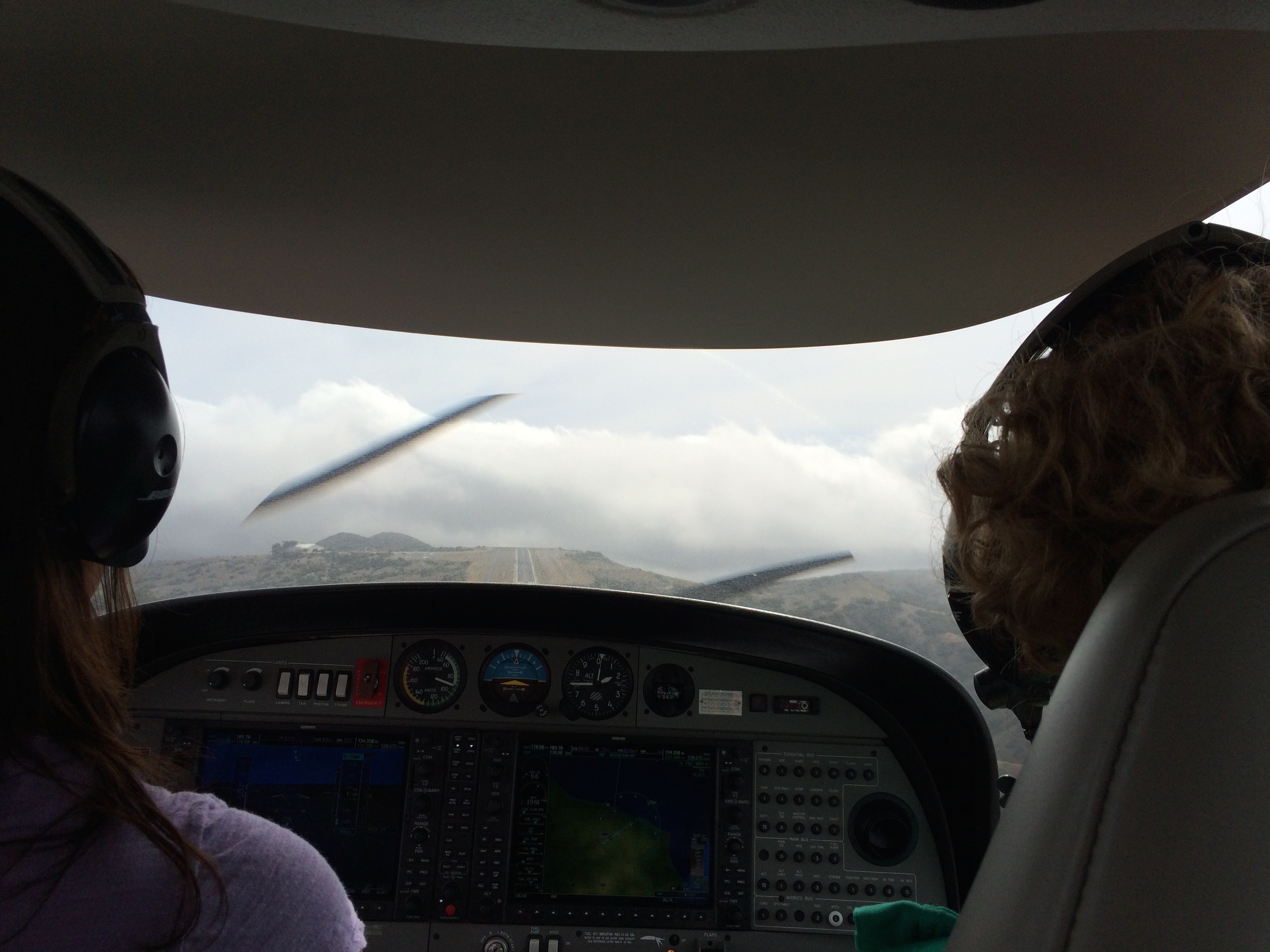
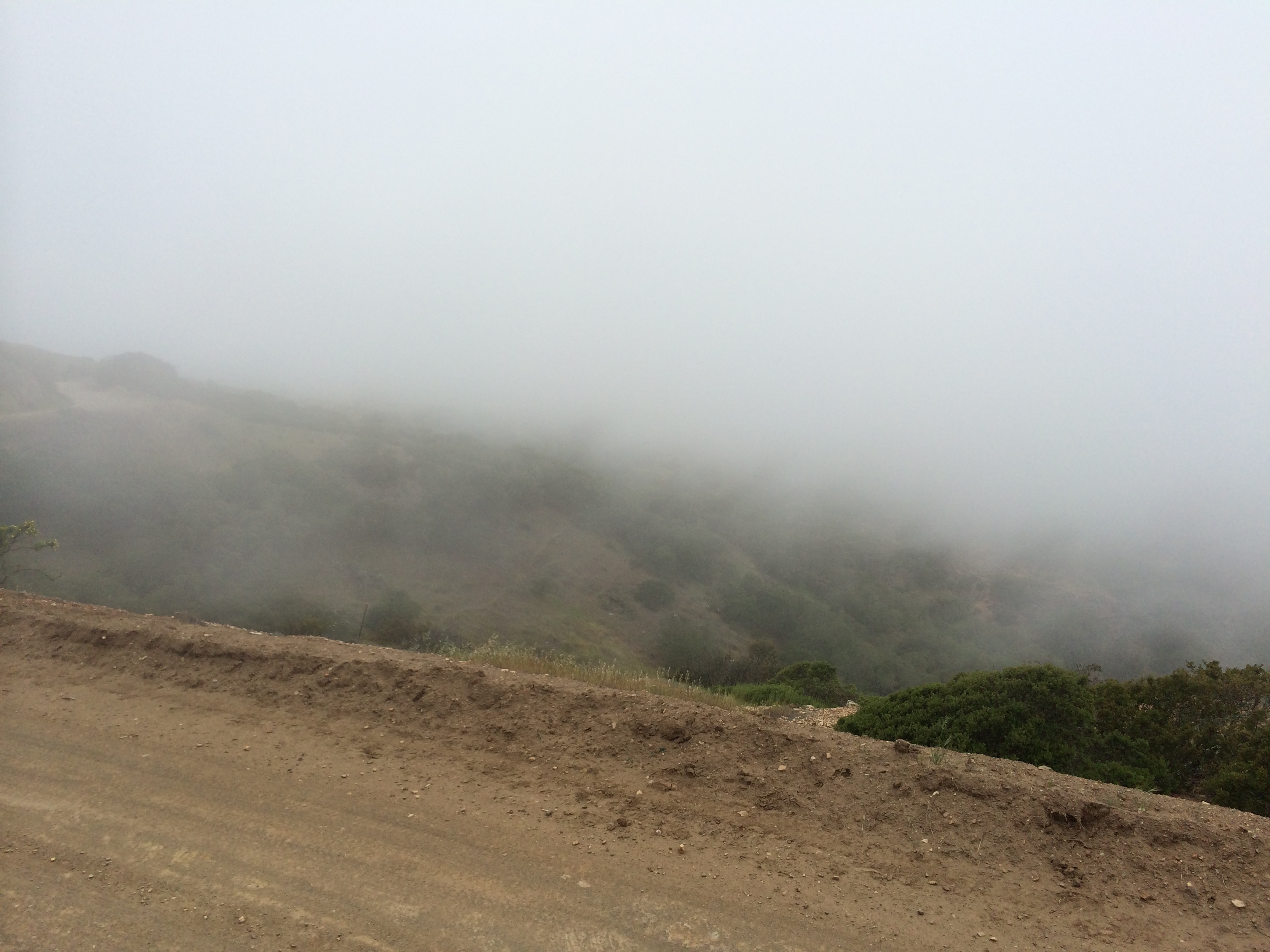
There have been a few times that I have done the hike with Nell that we wound up sort of hustling back to the airport because we saw a cloud bank sweeping in from the south and threatening to cover the airport. I can think of twice that we took off with a small tailwind so that we could remain VFR since there was a big wall of clouds at the end of 22. This looked a little more serious. In fact, if Susan’s plane didn’t have synthetic vision (which allows for a takeoff with a zero-foot ceiling and zero-miles visibility with some confidence in where the runway is), I would have started wondering about the ferry schedule from Two Harbors to get us home. As we rounded the north end of the airport I started pecking out an IFR flight plan on my iPhone and, as we came within range of the cell tower, Foreflight filed it for me. The wind had really started whipping over the hills, making a departure on runway four unlikely. (Four Cessna 172 and a Caravan had departed runway four as we were parking, but the wind was less than ten knots then.) The clouds were now sweeping into the valleys between the hills and they were lower than our hiking trail.
Susan asked if I wanted to fly back. An instrument departure from a non-towered airport, in someone else’s plane, instantly into a fog bank with an indeterminate ceiling, on an instrument plan I’d never flown before? Sure! Once we were back in the plane, with Susan sitting as a passenger in the back of her own Diamondstar, I tried to remember how to collect an instrument clearance when there was no tower.
I tried calling SoCal directly on 134.35, which was the frequency we were talking to when we flew in and the frequency that controller had asked us to use when we departed. No answer. I don’t think he could hear us.
A little discussion amongst the three instrument-rated pilots in the plane and I called 800-WX-BRIEF. They said to call a second 800 number. It’s a little hard to hear the iPhone with the engine running, but when I called the second 800 number they said, “No, radio SoCal directly.” I explained they couldn’t hear us and they said use 127.4, which answered promptly and, between talking to the airlines told us to fly the standard instrument departure (I said we were “unfamiliar,” but before he got back to us with it, Jessie looked it up: climb to 2,300 feet on the runway heading then turn on course), then direct to the Santa Catalina VOR, direct Seal Beach VOR, direct to Santa Monica. I violated one of my usual rules of not multitasking while taxiing and put some of the flight plan in while we were (slowly) rolling toward the end of 22. I was so excited about my departure into what appeared to be a twenty foot ceiling that I forgot to do my run up. Bad pilot. Susan captured the take off on her iPhone:
That synthetic vision is great stuff. Solidly inside a cloud I felt like I was just flying along over the same hills I usually departed over. When I turned toward the VOR I didn’t have a flicker of concern that I might be flying into a hillside. That was nice.
I was extremely focused on flying the plane, getting us on course, and communicating with the controller, but Susan and Jessie both enjoyed the view and Susan shot some video that she sent me under the heading “The Beauty of IFR,” which is true:
Once we were halfway across the channel we were no longer in and out of clouds. Santa Monica was still VFR and I told the controller once he got us through the Bravo air space we would cancel IFR and land VFR. That’s what we did, since there was no reason to fly all the way out to ELMOO or DARTS for the approach into Santa Monica. We just did a sharp 180 over the Getty Center and came back in on a right base for 21. It was only after we had shut down, tied up, and started unpacking the plane that I realized Jessie hadn’t shot any video of Susan, our excuse for the flight in the first place. At least we saw buffalo on the hoof.
1 comment
Great story. Thanks for being Susan's friend. Sara Dost