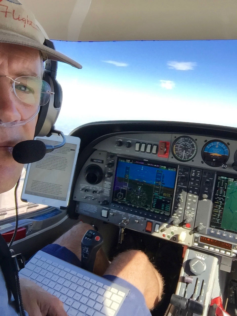
I am writing this blog entry almost three miles above the earth, tapping away on a little bluetooth keyboard, watching the words appear on the iPad that is held by the RAM mount suction-cupped to the canopy. At the end of every sentence I check my engine instruments, my navigation (time to next navigation fix), and glance at the fuel. That’s silly, since I have seven and a half hours of fuel for a two hour flight, but I have a ritual. I also pause to listen to the voices on the Air Traffic Control frequency, since I am “squawking and talking,” which means I have a discrete beacon code, ATC is watching me on the radar scope, and I have chatted with them about where I am going.
This is the first crossing in the new plane, so it seemed important to write it up.
Although I started in Friday Harbor on Monday morning, the first leg was only forty minutes long. I had flown Dexter up to my brother’s marine biology station so that he could be a lab assistant for six weeks. Just as we came abeam Seattle the R ECU A FAIL warning message came up. I had seen that before and it was a spurious warning. Moments later I got the R ECU B FAIL warning to go with it, which was new. There were no changes in the engine’s visible parameters. We flew on for another fifteen minutes and landed as planned on San Juan Island.
Texting my mechanic it sounded like another spurious error (the last one was a “cam sensor error,” impossible to actually generate at cruise, although that was where mine showed up). So I planned to fly down to Boeing Field on Monday morning and have Sean Quinn at Clay Lacy take a look at it. (He was recommended by Alex, a fellow at Galvin Flying, since they had a fleet of Diamonds for a while.)
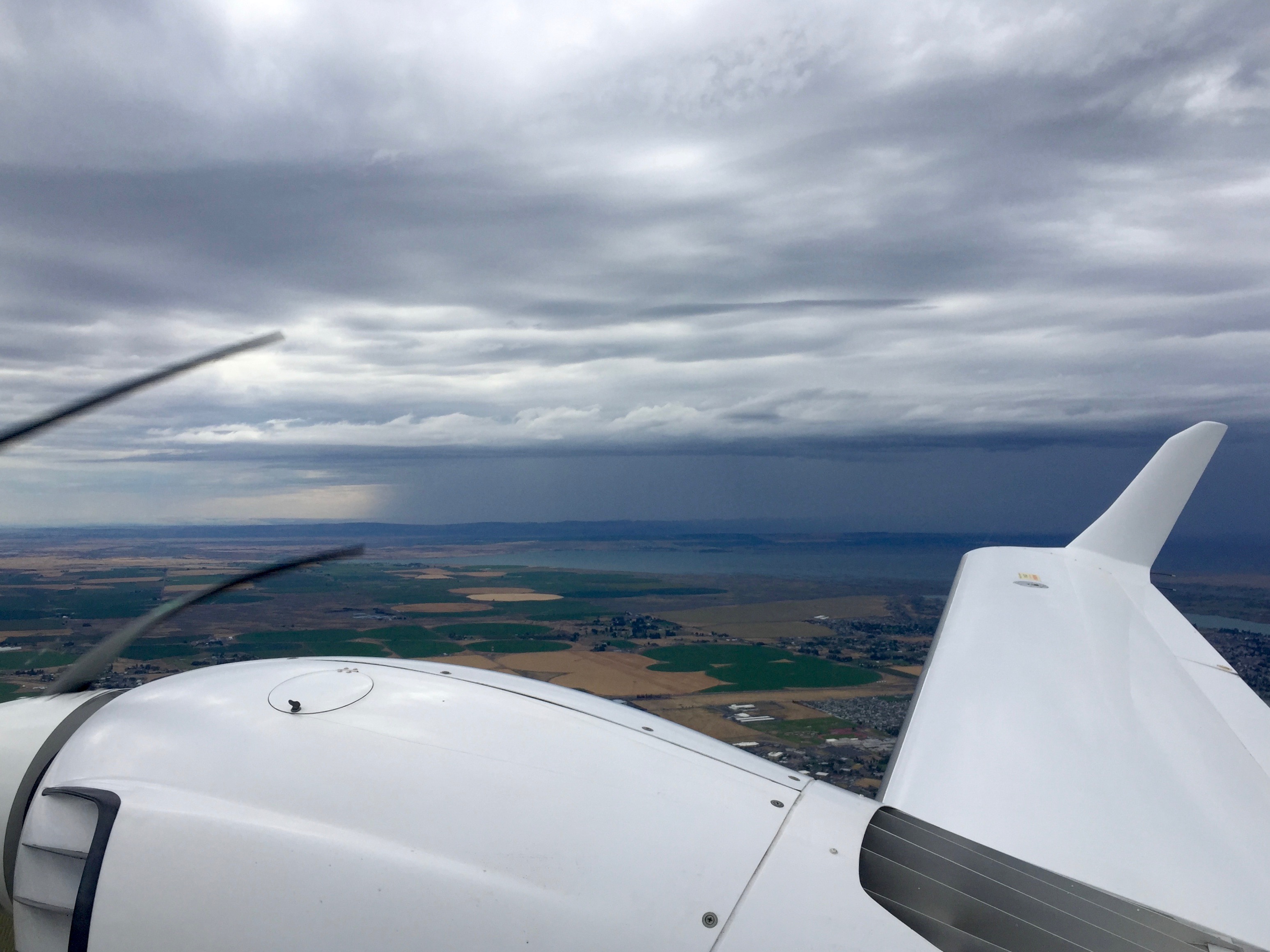
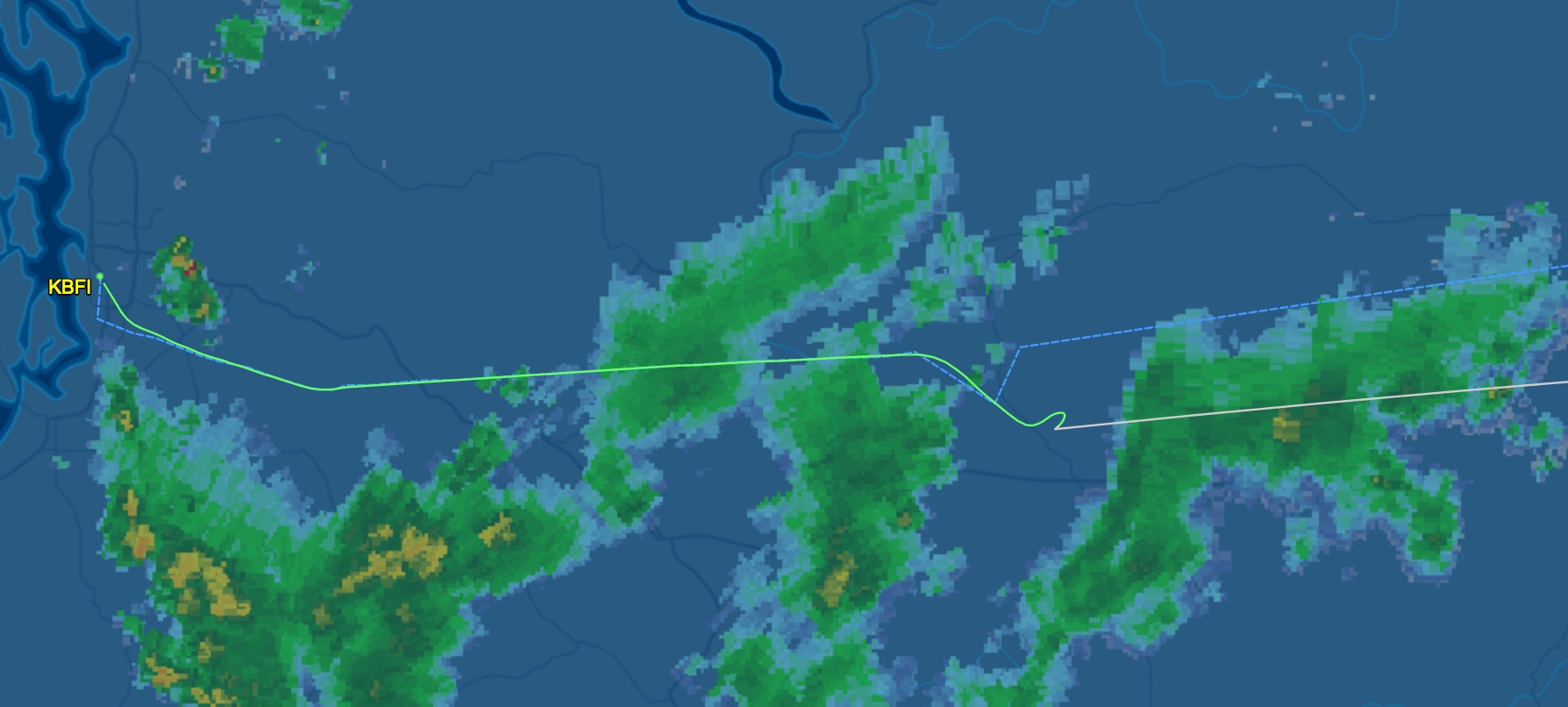
I checked the METAR for both my departure and arrival airports before I took off. Really, before I had rolled out of bed. Both were fine, there were some clouds up high down at Boeing. Then as I took off from Friday Harbor I heard people flying along IFR and someone talked about their instrument approach into Boeing. The approach controller said, “Yeah, they’re pretty busy in there because either they reported things worse than they were or they just got stacked up somehow.” I looked at the NextRAD images for my route and there was some precipitation along the way, but nothing that I thought would make a difference. Then I remembered my brother talking about a “convergence zone” that was between the San Juan Islands and the mainland. Things could change quickly there.
So I did something I hope to never do again: I asked a controller in the Northwest for an instrument clearance into an airport. Technically, you should file a instrument flight plan on the ground and get the clearance read to you by a ground controller or, in a case like Friday Harbor where there is no ATC facility, by calling an 800 number. So the approach controller I was talking to said, “You’ll have to talk to Flight Service to file a flight plan.” Off to a different frequency who said, “Uh, we’re in Canada, I don’t think we can file for you between two American airports.” Sorry. Off to another frequency, talking too quickly to a guy that wanted the information in order for a form that I didn’t have handy. I bet memorizing the order of the information is something you have to do for commercial flying. He read me back the information, I switched back to the approach controller, had HIM read my clearance to me, and then I was “in the system” and on the way to Boeing on an instrument flight plan. (In Southern California the controllers constantly give "pop-up clearances" to little planes. It appears to be standard procedure. I'm not really sure why there is a difference between the two areas.)
That proved to be entirely unnecessary. The NextRAD was probably a little delayed (it always is), and the radar probably picked up some ground clutter (it often does around cities), so I just flew directly into Boeing without more than a little mist hitting the canopy. Lesson learned, you can always fly ahead, poke around, and turn back if you need to. Have the engine warnings on probably made me a little more nervous about moving forward rather than doubling back.
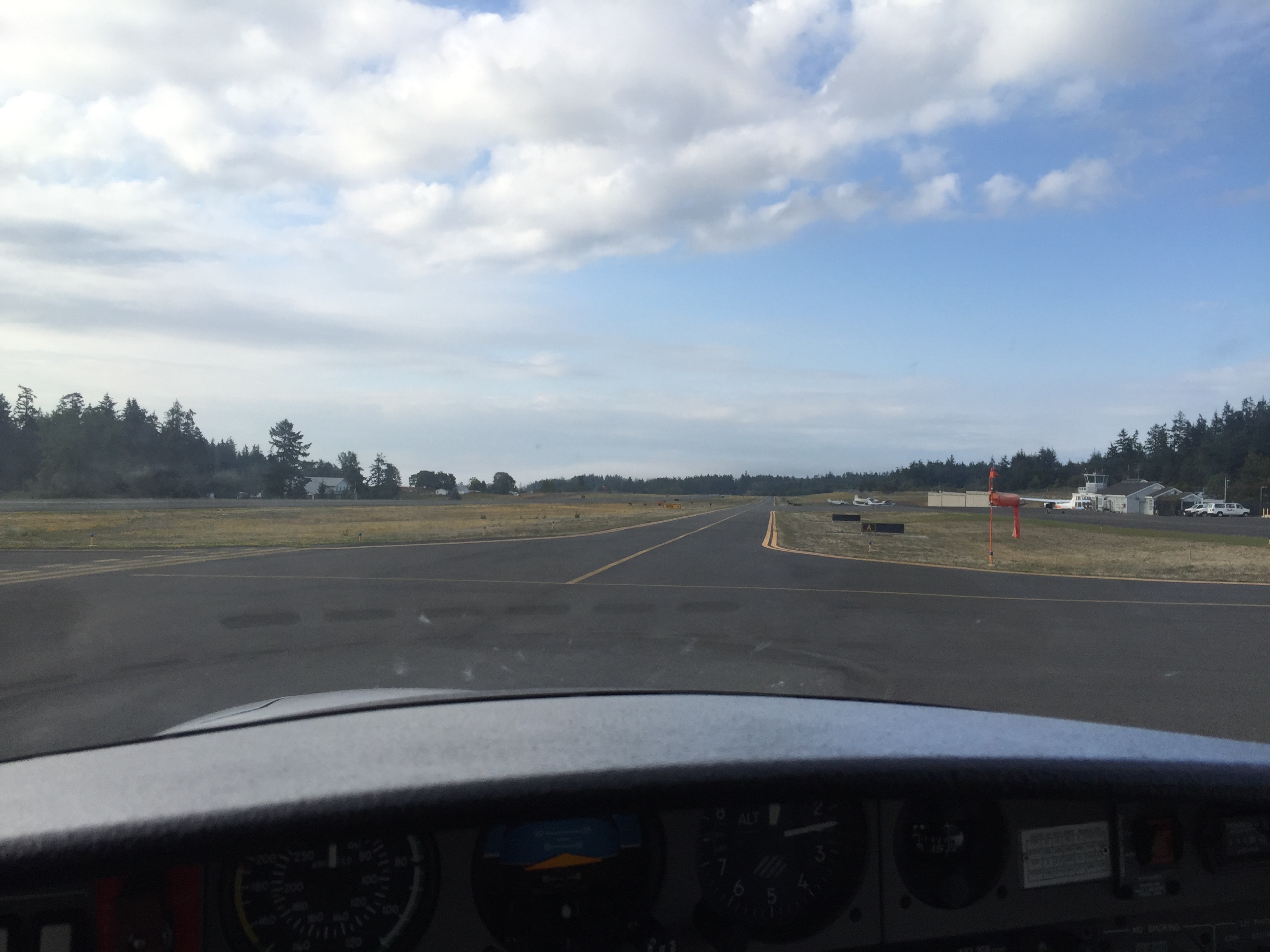
I landed and taxied to the Clay Lacy piston maintenance hangar. I texted Sean that I was there and just as I was opening the canopy he popped out to the parked planes and said, “I think you probably have a leak in an manifold hose.” He started to hook up the computer that would download the error messages and I went off to breakfast. Just as I finished my scrambled eggs, he called to say that was the problem and that he had fixed it. I was ready to go.
To plan a long flight I just put my destination into ForeFlight and let it draw the Great Circle Route I should be following. Then I pick an airport that’s about three hours ahead and fly toward it. If I need to land sooner for a restroom break, I do. If I feel like I can press on another half hour and get to a different airport, I do that. It’s just a placeholder, so that when I file an instrument flight plan (which I was filing ahead, after my flight from Friday Harbor) I have a destination to plug in. (Once you are aloft it’s not difficult to change your destination, you just tell ATC that what you need to do, they generate a new instrument clearance, read it to you, you read it back, and you are on your merry way.)
So I filed to Great Falls, Montana. The freezing level was reported at 12,000 feet. The plane was full of deicing fluid, so I filed for 11,000 feet. This was a route that I had never flown. If I were planning it today I would note that the high terrain of 9,000 feet is just short of Great Falls. So I could have flown all the way to Moses Lake VOR at 7.500 feet, and then climbed after I’d gotten past the storm.
Hindsight. You can learn from it.
My Stratus 2s is my backup for my backup, but the truth is that it makes all of my in-flight tools better and faster to use. I can check the weather at an airport more easily in ForeFlight on the iPad mini than I can on the G1000’s MFD. Foolishly, I had updated the firmware in flight on the way up with Dexter. (I was VFR and got a little antsy since ForeFlight told me it had downloaded the update already…) Never update your equipment on a trip. Wait until you get home. Certainly never update it while flying. I did and the Stratus promptly went to sleep. Not a big deal, we landed an hour later in Medford and I turned it on manually before we took off again.
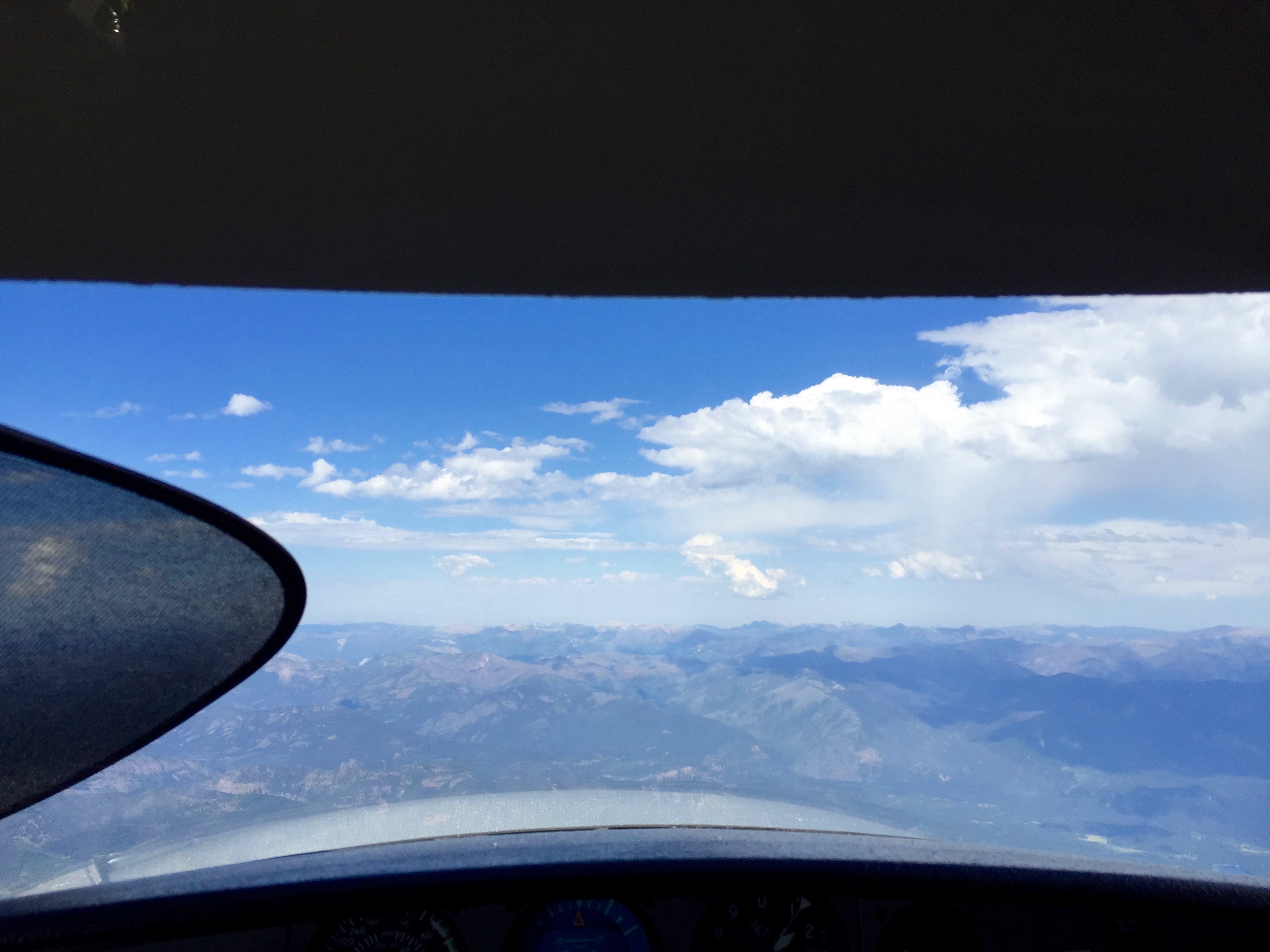
I forgot to turn it on before I started the engines at Boeing. (In part because you have to flip the master switch, then turn on the Stratus. I think. I’ll check that next flight.) So as I climbed to 7,500 eastbound from Boeing I went to check the radar imagery that the ADS-B should have downloaded and it wasn’t there. Not a big deal, I had it on the MFD as NextRAD. But it made me a little uncomfortable. Then as the controller had me climb to 11,000 I had the FIKI system running and when I tested it at the higher setting (to make sure both pumps were going) it gave a DEICE LO PRESSURE warning message. It vanished when I switched back to normal. I was in and out of layers, sometimes with the most spectacular views of sky, cloud, and mountain, and then inside a cloud again with a bumps and a loud spray of rain.
Listening to the airlines (almost all airlines, always makes the little plane pilot a little cautious) talking about their climbs a SkyWest pilot said, “Pilot report: we had moderate rime icing from 14,000 through 23,000. Okay, so there is icing above me, of a sort that we are not equipped to enter at all. That’s a data point.
As I climbed past 11,400 (the controller wanted me a little higher) I got a spray of rain and it stayed on the windshield. Ice. Lower than forecast and different from that report three minutes ago. Outside air temperature (OAT) was 32F. I told ATC we needed to go lower. They were already vectoring us a little north to go around the heavy part of the storm and they said we could descend to 11,200 or we could turn more south. We dropped to 11,200.
Sometimes I post photos of myself reading a book on the Kindle at altitude. Sometimes I’ll show myself typing an email, or I’ll take a bunch of photos of the sunset. There are no photographs of the inside of the plane for this flight. I was doing nothing other than flying the plane, similar to the hard IFR flight Dexter I did. If I had passengers they would have been getting a few words here and there, but I would have trusted them to listen to their music or podcasts and I’d have isolated myself to keep in touch with ATC. I was allowed to descend to 9,000 about fifteen minutes later.
But I was not happy. I looked at the radar images NextRAD provided on the PFD and estimated that I was going to be in this unpleasantness for another hour. Without my Stratus. Bouncing along over mountainous terrain I was unfamiliar with. I was direct to the Lake Moses VOR at that point and I saw that the Lake Moses airport was nearby. I checked their weather. They had some light rain and a ceiling of 9,500 feet. No instrument approach necessary. I could land and be out of the rain, have a snack, power up the Stratus, take a nap, study the route some more… I told ATC I wanted to change my destination. They were happy to no longer have to deal with such a high maintenance client in the IFR system, cleared me for the visual approach, told me all about the airport and handed me off to the tower.
It is a military airport so there were these huge C-5 cargo jets (huge four engine grey Boeing jets that the military uses to move supplies) on training flights either circling the airport or shooting instrument approaches. I landed just ahead of one on a crossing runway, taxied to the FBO and shutdown. After a snack, a nap, re-fueling and a call to Nell, I got back in the plane. I took off VFR because there were such high clouds to the east. And, in fact, I was able to climb to 13,500 without getting near any clouds, and eventually was direct to Missoula, Montana. Everything was smooth and I could enjoy my view of the Northern Rockies.
Even with all of the improvements of the new plane over the old one, it is really important to remember the biggest factor in managing the risks of aviation is the decision-making skills of the pilot. There is no prize for pressing on against bad feelings. I have been watching a lot of accident videos and in so many of them there is a moment where I think, “Why did he press on from there? Why not land? I bet there was a cheap hotel nearby, the FBO probably had a sleep room…”
1 comment
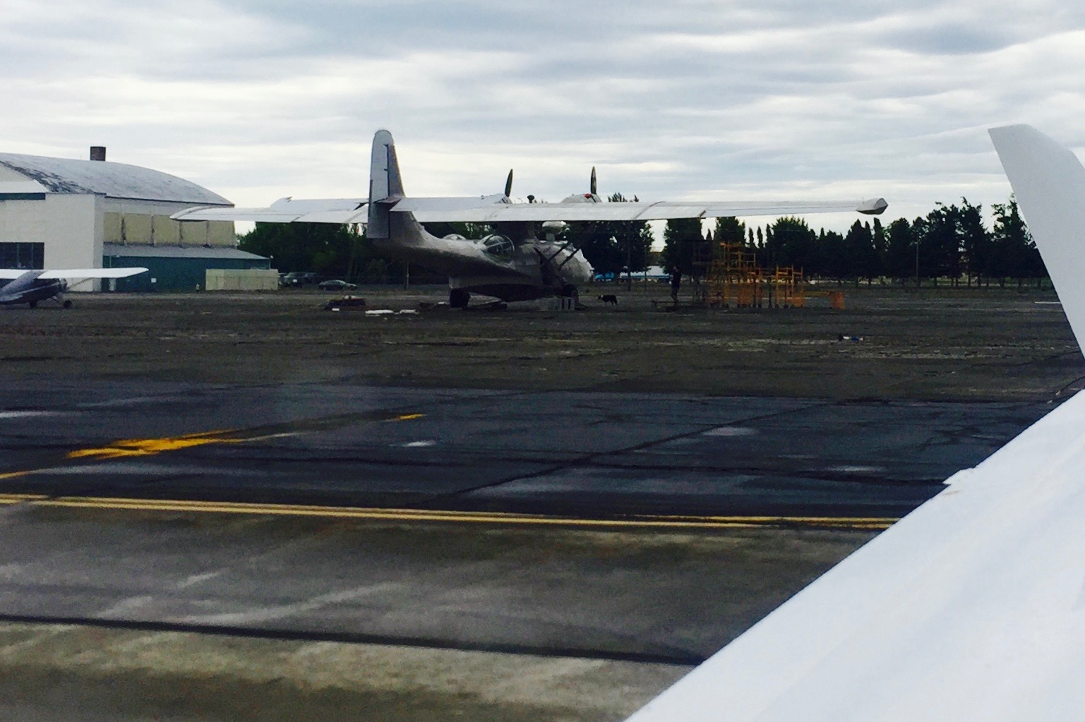
Hey Colin, the picture of the amphib looks like a PBY Catalina. Couldn't enlarge it to be sure, but the fuselage looks like it has a center pylon for the wing, if that's the case, Catalina for sure. The Albatross has the wing mounted high directly to the fuselage.