

N972RD want to be in that sky
As Nell and I return to the east coast after escaping the single-digit temperature for a month, she flew on a large jet and I crossed in the little plane. Again. And when I was talking to her from Kansas City, where I had stopped for the night, she said, “Aren’t you lonely in the plane? What do you do?” I was momentarily stumped. What am I doing up there? JetBlue can get my butt to Boston a lot faster, I’ll have WiFi the whole time and if the goal is to be in Cambridge a little ahead of Nell, then it’s smarter to be in the big jet. There must be something else going on. Still going on, after a dozen years.
Science, freedom, beauty, adventure: What more could you ask of life?
– Charles Lindbergh
For a lot of the time, I am busy. Certainly within an hour of landing and for an hour after taking off, I am planning, talking, gathering information to increase my situational awareness (weather, runway lengths, FBO location, where are the airliners coming in from), and changing our course and altitude. So on a four hour leg I’ve got two hours to myself, interrupted with some regularity to talk to Air Traffic Control (I am always on frequency with someone, and they are watching me on the their radar screen) or to collect the usual information (has weather changed up ahead, how are the engines doing, what does the fuel range look like?).


SMO – ABQ. On the leg from Santa Monica to Albuquerque I was a sightseer. I find that piece of our country among the most beautiful. Our impact on it is so minimal. From above, our settlements (and attempted settlements like California City) are the barest scrapings on the surface of this vast landscape. We talk of trying to keep the planet healthy, but the truth is we only need to do that for ourselves, so that we will survive. Looking down into the desert at an abandoned open mine, or the GM test track facility, or a cluster of buildings where a dozen people are fighting entropy and Mother Nature, it is obvious that in fifty years the scars are already healing over and in a hundred you probably wouldn’t be able to tell which roads had homes on them and which didn’t.


We enter that desert through the Cajon Pass, leaving behind the Los Angeles basin where the carpet of houses makes our eventual smother of the globe seem like an irresistible truth, impossible to veer from. Moments later I am over open space, hostile space, uncultivated, unsettled, unimproved. Since it has resisted our advances for over a century, I believe it will continue to do so. I am surprised (every time) when I cross a series of ridges and come into the Prescott valley. Carpeted with more solid clumps of stucco homes huddled against the withering heat and the bleak cold of the desert. There’s a flight school, so my traffic scope is often crowded with their targets which end in ER. Just as I start to contemplate the ugliness of most planned housing developments the desert rises to the buttes around Sedona. Red rock walls (which have claimed a few airplanes) and moss-smooth carpets of a dull grey-green grass flash below me. There are water holes, some for cattle and some for humans. When I am lucky my route takes me over the Crater and I ponder what it was like when something that large slammed into the earth.


And then it is high, empty desert with some buttes, ridges and canyons, all the way until I reach the red-roofed tide of Albuquerque’s valley. For anyone thirsty for the majesty of our natural environment they should treat themselves to a low-level flyover of this route. I find it incredibly soothing, reassuring, and educational every time.


ABQ – MKC Leaving Albuquerque, especially in the afternoon, takes some focus. Even in the dead of winter, the density altitude is considerably higher than sea level, which means the plane rockets down the runway at close to 90 mph before there’s enough lift for it to claw its way into the air. I keep the nose low to build speed and establish a real climb before I raise the landing gear. My turn on course is purposefully shallow. I have the terrain shading turned on for the moving map, and I watch as the Sandia Mountains turn from red, to yellow and eventually sink more than a thousand feet below me. There’s a thirty knot wind from the west which I rode along to an earlier-than-usual landing at the SunPort. Now I heard a pilot complaining that he needs to change his route and my ATC guardian angel warns me: “At eleven o’clock and forty-five nautical miles a pressurized Centurion reported moderate turbulence.” I immediately altered my course more to the south so that I would fly over Dalhart, Texas. Getting away from the Rockies when the wind is that strong is a prudent choice. (Even airliners are cautious about that wind. Multiple passenger jets into ABQ were slowing, changing course, and asking for reports of the mountain wave action.
So I turned tail and scooted toward the flatter parts.


Looking at the maps ahead, I could see the Flight Category for each airport. Green means there is at least 1,500 feet of clear air over the airport. Blue means less than that: you can land VFR but you’ll need special permission. Red means you can’t get into that airport without an instrument approach; pink means you are absolutely insane. (That’s not true. Pink means that the ceiling is below the minimums of the instrument approach for the airport. So maybe you could take off from there, but you probably won’t be able to land. My rule is to never take off unless I can turn around and land again, just in case something goes wrong. My rules and the FAA regulations deviate from one another on occasion, always in the direction of minimizing risk, always in the direction of them saying, “It’s okay, you can fly,” and me saying, “It’s okay, I’ll fly later.”)


I study that map and try to figure a way through the stuff which doesn’t look as friendly. It’s not a real map of the risks, because there is no three-dimensional representation of the cloud cover. It could be that the clouds are only two hundred feet off the ground, but they are only two hundred feet thick. Less than thirty seconds in the cloud and I’d be climbing above it. But there’s no way to tell.
(There is some information out there about cloud tops. My map can even show it, but it is usually the top of the highest layer. That is often a layer hovering up at 25,000 feet, near the top of the troposphere. And I fly around all day long below 25,000 feet. Some day we will have data gathering instruments on every plane and they will beam that information back to the ground and back up to the other planes. You will know exactly what the tailwind is like at 11,500 compared to 13,500 and your plane will tell you whether it is worth another five minutes of climb time. That’s a ways off. For now I have to stare at those colored dots and wonder a little.)
When it is this cold, I will alter our course to get to the green dots. I’ll add a couple hours to the cross-the-country time if I need to, in order to remain in clear air. I thought, when I was planning this flight a few days earlier, I might stop in Memphis. Maybe if I skirted down to the warmer south I could avoid the winter storm they were talking about for the Northeast. There’s a museum down in Alabama dedicated to the victims of lynching which I would like to visit. The little plane is the only way I’m going to make it to a place like that. But the weather started to get worse in the southern portions, and it started to improve a little up north.


Looking at St. Louis as I left Albuquerque I saw that it had “light freezing rain” in the report. That elicits a hard no from little Two Romeo Delta. I think it’s a hard no from a lot of bigger planes, too. Kansas City looked better. It even looked clear the next morning (that was a lie, it turned out). So I headed there and started checking the weather and expected weather along the route from Kansas City to Norwood, Massachusetts. There was some mystery past Cleveland where the predictions were for a 4,000 foot ceiling but a few miles away there were expectations of “clear below 12,000 feet.” That doesn’t really make sense unless it is a wall of clouds or a thin little layer. I decided to hope for the latter as I planned a night in Kansas City.
It’s possible that as a pilot you learn too much about the weather. I love it. I wish I had a weather guru flying along with me sometimes. I know there are more data gathered about the weather above the nation than I will ever hope to understand. Adiabatic lapse rates. The dew point spread. Cold front behavior as it meets a warm front. I’d love to know it all, in the same way that I would love to be fluent in Italian. It’s not going to happen, but I read what I can. It is a science which keeps me alive and makes things so much more convenient (being alive is the ultimate convenience). If I had to take off from ABQ and just hope things were clear on my way to Norwood all my trips would be a lot longer. I’d spend a lot more time in tiny towns with bad motels.


On all these flights I marvel at the engineering of the plane, the science of aeronautics, and the design of all the things I’ve been touching and fiddling with for over a decade during 2,600 hours in the sky. I do my part to nudge little bits of the experience toward perfection. My backup-for-my-backup used to be mounted on a suction cup on the canopy right next to me. After half a year of bugging my mechanic I finally got a screw long enough to secure a mount to the instrument panel directly. Occasionally the suction cup would let go, especially if I was climbing above ten thousand feet; now that can’t happen. I haven’t gotten it situated perfectly, but I’ve got a good handle on it.
 We support a charity which helps send Native American students to college. They sent me a keychain with a dreamcatcher on it. Since a lot of my flights cross directly over their nations, and since I often think about what their lives across this landscape must have been like before settlers arrived, I like having my ignition keys on that now.
MKC – BKL Arriving at the Kansas City Downtown Wheeler airport in the morning, I find the clouds lurking two thousand feet above. It is 28F on the ground and I don’t want to climb through freezing clouds of an uncertain depth. So I depart, climb up to just below the clouds and motor along, waiting. After about twenty minutes the sky opens for a moment, shafts of sunlight are spotlighting a small town in Missouri. I am sure they feel special. I give the plane a little extra throttle, aim the nose at the faded blue and climb up into the sunshine.

A Good Book
Once I reach my cruising altitude of 15,500 feet I open my Kindle and start Knucklehead. It’s (so far) a brilliant book by Adam Smyer, a high school classmate of my brother. I read the whole first third of it at 15.5k sliding across our country. It feels like the first third of the book is to set up for bad things to come, so I have to stop and listen to Lake Street Dive for an hour instead. I study my weather some more as I am starting my very slow VFR descent into Cleveland.
I had a bottle of Mexican Coca Cola with me from Los Angeles, which I thought I might need on the first leg, but did not. In Kansas City I left it in the plane by mistake, which meant I couldn’t have it as my morning coffee, and also meant I spent a little time worried that the cold would freeze it, explode the bottle, and make a disaster area of the back seat. Apparently it wasn’t that cold in Kansas City. So my lunch in Cleveland was a bottle of Coke (with real sugar) and a bag of FBO popcorn.

Along the edge of a great, frozen lake
BKL – OWD After my regulation seventeen minute nap, I was back in the plane, climbing out over the Ohio farmland. Half an hour in, before I flew over the thin, low overcast which explained those blue dots on my map, I watched the farms of western Ohio. They were still covered with snow and it was so beautiful to see the grey forest, the white fields, and the dark, nearly black buildings. One was such a fascinating figure ground that I would have circled to sketch it if I had a co-pilot. Architecture is the only art where you get to inhabit the figure ground the artist has created (okay, maybe Richard Serra’s sculpture as well).
It was all so beautifully to watch meander under the wing of the plane.
So I pilot, plan, read, listen to music and enjoy the sights up here. And I will for as long as I am able to do it safely.
Sometimes up here, I write a blog post. With a thirty-two knot tailwind.
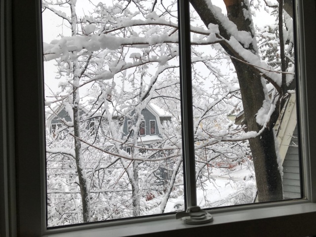
The morning after I landed

Great story Colin. That is “real flying” to me. Lindbergh had it right with his quote, I would simply add the satisfaction and sense of self accomplishment of “doing it yourself” to the list. It is an addictive thing for someone who enjoys solving problems and has an adventurous and/or freedom loving nature. Smoke em if you got em, the day will come when we don’t (whether it be health, economics, or regulated to death)!
I treasure all your posts. They don’t come out as often as I would like but they are a real treat when they arrive. Another great post Colin. I’ll be patiently waiting for the next one.